1955 Map of Wailuku
USGS Topo · Published 1974About this map
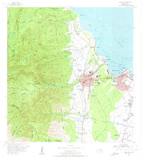
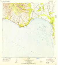
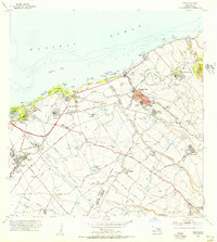
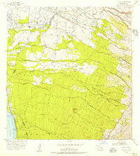
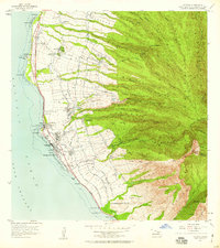
The town of Wailuku and the neighboring industrial harbor at Kahului anchor this mid-century Maui landscape, revealing a transition from agricultural roots to modern infrastructure. Extensive water management systems including the Waiale Reservoirs and various ditches support the surrounding sugar lands, feeding into the Sugar Mill operations at Puunene. The map documents a dense network of worker housing and small communities like McGerrow Village, Ah Fong Village, and Hyashi Village, which stand alongside growing residential areas such as Wailuku Heights and Paukukalo.
Find a feature on this map
88 named features on this map. Tap any name to fly to it.
Don’t see what you’re looking for? This feature index may not catch every label — zoom into the map to look around manually.
Map Details
Editions of this 1955 Wailuku Map
2 editions found
Other maps of this area

1954 · Maui
USGS Topo · 1:250,000
1954 · Maalaea
USGS Topo · 1:24,000
1954 · Paia
USGS Topo · 1:24,000
1954 · Puu O Kali
USGS Topo · 1:24,000
1955 · Olowalu
USGS Topo · 1:24,000

1955 · Wailuku
USGS Topo · 1:24,000

1955 · Kahakuloa
USGS Topo · 1:24,000
1956 · Lahaina
USGS Topo · 1:24,000

1956 · Honolua
USGS Topo · 1:24,000

1966 · Maui
USGS Topo · 1:250,000