2020s Maps of Southpointe at Waiakoa, Maui County
Explore 2 historic maps of Southpointe at Waiakoa from the 2020s. These maps offer a rare glimpse into what life looked like during the 2020s — showing old roads, neighborhoods, homes, and landmarks that have changed or disappeared over time.
Whether you're researching your family's past, planning a metal detecting trip, or studying how Southpointe at Waiakoa's landscape evolved across the 2020s, these high-resolution maps are a powerful tool for exploring the history of this region.
- Focus on a specific era: All maps on this page are from the 2020s, giving you a focused view of this time period.
- See what’s changed: Compare century-old streets, trails, and buildings to today's modern landscape using overlays and satellite layers.
- Research with precision: Use these maps for genealogy, historical research, land use analysis, or educational projects.
- View, download, or print: Maps are fully viewable online in high resolution, and can be downloaded or printed for your own records.
Start exploring Southpointe at Waiakoa's history through authentic maps from the 2020s. This is your window into the past.
Southpointe at Waiakoa, Maui County maps
(2)- 2024 Map of Puu O Kali, 2024 Print
 2024 Puu O Kali2024 Print · USGSMaui's leeward coast and volcanic uplands are captured here in the early twenty-first century, showing the expansion of coastal communities. Genealogists and researchers can locate Lihue Cem, Puu Hele Cem, and the historic Trinity Episcopal Church By the Sea.
 - 2024 Map of Maalaea, 2024 Print
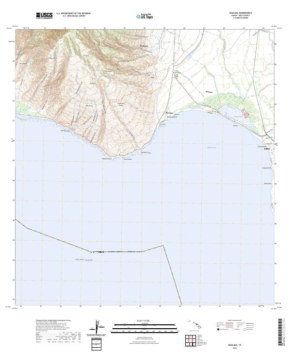 2024 Maalaea2024 Print · USGSModern Maui comes into focus in this recent survey of the island's central isthmus and southwestern slopes. Researchers can trace coastal development near Kihei and Mā‘alaea or explore the protected wetlands of the Keālia Pond National Wildlife Refuge.
End of results
Showing maps 1-2 of 2
Frequently asked questions
- What are the different types of historical maps available for Southpointe at Waiakoa?
- What is the oldest map of Southpointe at Waiakoa?
- Where can I purchase historical maps of Southpointe at Waiakoa for my home or office?
- Where can I download high-res historical maps of Southpointe at Waiakoa?
- Are there historical topographic maps available for Southpointe at Waiakoa?
- Is there historical aerial imagery available for Southpointe at Waiakoa?
- Where are historical maps of Southpointe at Waiakoa sourced from?