Old Maps of Southpointe at Waiakoa, Maui County for Academic Research
Study the evolution of Southpointe at Waiakoa with 15 high-resolution historic maps. Whether you're teaching, researching, or modeling changes in land use, these maps provide essential visual documentation of urban, environmental, and geographic change.
- Analyze long-term change: Track patterns in development, transportation, and natural features.
- Ideal for environmental or urban studies: Support academic projects with primary historical map data.
- Use in the classroom or lab: Educators and researchers rely on these maps to bring historical context to life.
These maps are a powerful tool for teaching, research, and visualizing how Southpointe at Waiakoa has changed over the decades.
Southpointe at Waiakoa, Maui County maps
(15)- 1954 Map of Maui
 1954 Maui1954 Print · USGSThe central Hawaiian Islands are shown during the mid-fifties, detailing the agricultural and coastal infrastructure of Maui, Lanai, and Molokai. Genealogists and researchers can trace plantation-era history at Haliimaile Camp, locate old harbors like Kaumalapau Harbor, or explore the early bounds of Haleakala National Park.
 - 1954 Map of Maalaea, 1956 Print
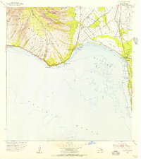 1954 Maalaea1956 Print · USGSMaui's central coastline in the mid-fifties reveals an island landscape defined by traditional homesteads and developing aviation infrastructure. Genealogists and historians can locate early settlements at Kihei and the Waikapu Homesteads, alongside the Old Maui Airport and the Kealia Pond wetlands.2 unique versions available
 - 1954 Map of Puu O Kali, 1956 Print
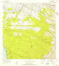 1954 Puu O Kali1956 Print · USGSMaui's leeward slopes are captured in the mid-fifties, showing a detailed network of residential homesteads and sugar-era camps. Genealogists can trace early properties in the Waiakoa Homesteads or locate family sites near Puu Hale Cemetery and Camp K-3.2 unique versions available
 - 1966 Map of Maui
 1966 Maui1966 Print · USGSThe central islands of Maui, Molokai, Lanai, and Kahoolawe are shown in detail during the mid-1960s as plantation life and early tourism coexisted. Genealogists and researchers can trace family locations in old plantation towns like Puunene, the harbor at Lahaina, and Hoolehua on Molokai.
 - 1974 Map of Maui
 1974 Maui1974 Print · USGSMid-century Hawaii is captured here through the detailed landscapes of Maui, Molokai, Lanai, and Kahoolawe as they appeared in the 1970s. Researchers can trace the layout of island hubs like Lahaina and Lanai City alongside remote landmarks like Wainapanapa Cave.2 unique versions available
 - 1983 Map of Maalaea
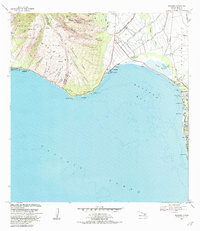 1983 Maalaea1983 Print · USGSThe shores of Maui are captured here in the early eighties, showing the critical junction between the West Maui mountains and the expansive bay. Local researchers can trace coastal developments from the Maalaea Small Boat Harbor to the inland Kealia Pond and the cemetery at Kihei.2 unique versions available
 - 1983 Map of Puu O Kali, 1984 Print
 1983 Puu O Kali1984 Print · USGSUpcountry Maui in the early eighties reveals a unique landscape of high-elevation homesteads and volcanic terrain. Genealogists and researchers can trace land divisions at Kula Homesteads and find local landmarks like Pau Hele Cemetery and Keokea.
 - 1992 Map of Puu O Kali, 1999 Print
 1992 Puu O Kali1999 Print · USGSThe western slopes of Maui are shown during the early nineties as residential and agricultural subdivisions expand toward the coast. Researchers can trace land grants and water rights through the Waikoa Homesteads and the complex Haiku Ditch irrigation system.
 - 1996 Map of Maalaea, 1999 Print
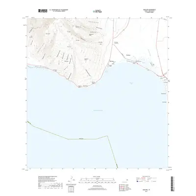
 1996 Maalaea1999 Print · USGSCoastal Maui in the mid-nineties shows a landscape defined by the transition from rugged forest ridges to the expanding shoreline communities. Researchers can trace the development of Maalaea and Kihei, or locate landmarks like Kealia Pond and the Maalaea Small Boat Harbor.
 - 2013 Map of Maalaea, 2013 Print
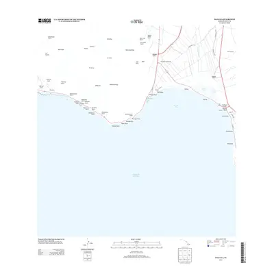 2013 Maalaea2013 Print · USGSCovers Southpointe at Waiakoa, including Maʻalaea, Maui County, and other nearby areas
 - 2013 Map of Puu O Kali, 2013 Print
 2013 Puu O Kali2013 Print · USGSCovers Southpointe at Waiakoa, including Kaonoulu, Kihei, and other nearby areas
 - 2017 Map of Puu O Kali, 2017 Print
 2017 Puu O Kali2017 Print · USGSCovers Southpointe at Waiakoa, including Kaonoulu, Kihei, and other nearby areas
 - 2017 Map of Maalaea, 2017 Print
 2017 Maalaea2017 Print · USGSCovers Southpointe at Waiakoa, including Maʻalaea, Maui County, and other nearby areas
 - 2024 Map of Puu O Kali, 2024 Print
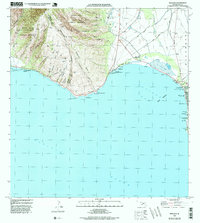
 2024 Puu O Kali2024 Print · USGSMaui's leeward coast and volcanic uplands are captured here in the early twenty-first century, showing the expansion of coastal communities. Genealogists and researchers can locate Lihue Cem, Puu Hele Cem, and the historic Trinity Episcopal Church By the Sea.
 - 2024 Map of Maalaea, 2024 Print
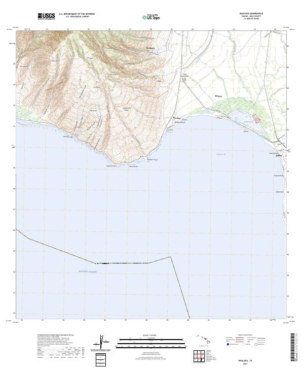 2024 Maalaea2024 Print · USGSModern Maui comes into focus in this recent survey of the island's central isthmus and southwestern slopes. Researchers can trace coastal development near Kihei and Mā‘alaea or explore the protected wetlands of the Keālia Pond National Wildlife Refuge.
End of results
Showing maps 1-15 of 15
Frequently asked questions
- What are the different types of historical maps available for Southpointe at Waiakoa?
- What is the oldest map of Southpointe at Waiakoa?
- Where can I purchase historical maps of Southpointe at Waiakoa for my home or office?
- Where can I download high-res historical maps of Southpointe at Waiakoa?
- Are there historical topographic maps available for Southpointe at Waiakoa?
- Is there historical aerial imagery available for Southpointe at Waiakoa?
- Where are historical maps of Southpointe at Waiakoa sourced from?