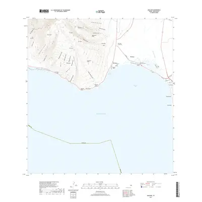
2017 Map of Maalaea
USGS Topo · Published 2017About this map
Maalaea sits at the northern arc of Ma'alaea Bay, serving as a critical junction between the West Maui Mountains and the central valley. The landscape is defined by a series of dramatic gulches, including Ukumehame Gulch and Hana'ula Gulch, which carve through the high ridges of Hana'ulaiki and Pu'uanu. Along the shoreline, the presence of the Keālia Pond Coastal Boardwalk and the massive Keālia Pond highlights a coastal ecosystem where freshwater from the Waikapu Stream meets the Pacific. This 2017 survey details the area's infrastructure, from the Puu Hele Cinder Pit to the small settlements at Kanaio and Palalau. Historically significant points like McGregor Point and Aalaloloa Pali provide navigational and geological markers for the coast, while Kapoli Spring indicates essential water sources in this transition zone between mountain and sea.
Find a feature on this map
53 named features on this map. Tap any name to fly to it.
Don’t see what you’re looking for? This feature index may not catch every label — zoom into the map to look around manually.
Map Details
Editions of this 2017 Maalaea Map
This is the sole edition of this map. No revisions or reprints were ever made.
Other maps of this area

1929 · Kahoolawe
USGS Topo · 1:62,500

1954 · Maui
USGS Topo · 1:250,000

1954 · Maalaea
USGS Topo · 1:24,000

1954 · Paia
USGS Topo · 1:24,000

1954 · Puu O Kali
USGS Topo · 1:24,000

1954 · Makena
USGS Topo · 1:24,000

1955 · Olowalu
USGS Topo · 1:24,000

1955 · Wailuku
USGS Topo · 1:24,000

1956 · Lahaina
USGS Topo · 1:24,000

1966 · Maui
USGS Topo · 1:250,000