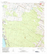
1983 Map of Puu O Kali
USGS Topo · Published 1984About this map
Puu o Kali rises prominently above the complex agricultural and residential divisions of the Upcountry Maui landscape. This 1983 revision illustrates a transition from the dense Kula Homesteads to the more open slopes descending toward the Pacific Ocean. The map meticulously details the unique homesteading pattern of the era, including the Pulehu Iki and Kamehameha Homesteads, which are defined by long, narrow parcels designed to provide residents with diverse elevations for farming. Civil infrastructure is marked by the Haleakala Highway and the numerous gulches like Waiakoa Gulch and Kulanihakoi Gulch that channel seasonal runoff down the mountain. Local history is preserved in the location of the Pau Hele Cemetery, Lihue Cem, and the Rice Memorial Park near Keokea.
Find a feature on this map
32 named features on this map. Tap any name to fly to it.
Don’t see what you’re looking for? This feature index may not catch every label — zoom into the map to look around manually.
Map Details
Editions of this 1983 Puu O Kali Map
This is the sole edition of this map. No revisions or reprints were ever made.
Other maps of this area

1954 · Maui
USGS Topo · 1:250,000

1954 · Maalaea
USGS Topo · 1:24,000

1954 · Paia
USGS Topo · 1:24,000

1954 · Puu O Kali
USGS Topo · 1:24,000

1954 · Makena
USGS Topo · 1:24,000

1955 · Wailuku
USGS Topo · 1:24,000

1957 · Kilohana
USGS Topo · 1:24,000

1957 · Haiku
USGS Topo · 1:24,000

1957 · Lualailua Hills
USGS Topo · 1:24,000

1966 · Maui
USGS Topo · 1:250,000