
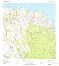
1957 Map of Haiku
USGS Topo · Published 1959About this map
The agricultural and coastal landscape of northern Maui is captured here during the late 1950s, showing a transition between plantation-era infrastructure and mid-century development. Established settlements like Makawao and Haiku serve as anchors, while smaller worker-associated sites such as Filipino Camp and Corn Mill Camp provide insight into the local labor history of the period. The northern coast is defined by dramatic geography, from the Coast Guard Reservation at Pauwela Point to the numerous gulches that carve through the Koolau Forest Reserve. Transportation is centered on the Hana Highway, which winds across the northern shore, and Baldwin Avenue, which climbs toward the inland heights. A complex system of ditches and siphons feeding reservoirs like Haiku Reservoir and Pauwela Res reflects the island's intensive water management for its sugar and pineapple industries, which defined the island's economy before modern tourism expansion.
Find a feature on this map
106 named features on this map. Tap any name to fly to it.
Don’t see what you’re looking for? This feature index may not catch every label — zoom into the map to look around manually.
Map Details
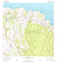
Editions of this 1957 Haiku Map
3 editions found
Other maps of this area

1954 · Maui
USGS Topo · 1:250,000

1954 · Paia
USGS Topo · 1:24,000

1954 · Puu O Kali
USGS Topo · 1:24,000

1957 · Kilohana
USGS Topo · 1:24,000

1957 · Nahiku
USGS Topo · 1:24,000

1957 · Keanae
USGS Topo · 1:24,000

1966 · Maui
USGS Topo · 1:250,000

1974 · Maui
USGS Topo · 1:250,000
1977 · Paia
USGS Topo · 1:24,000

1983 · Nahiku
USGS Topo · 1:24,000