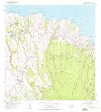
1957 Map of Haiku
USGS Topo · Published 1973About this map
The coastal terrain of North Maui is defined here by a dense network of water-management infrastructure, where the Lowrie Ditch, Koolau Ditch, and Wailoa Ditch traverse a landscape of deep gulches. Agriculture and processing are central to the local economy, anchored by the Pauwela Cannery and specialized settlements like Filipino Camp and Corn Mill Camp. Along the shoreline, the Pacific Ocean meets prominent features such as Pauwela Point and the Coast Guard Reservation. Further inland, the map captures the transition from the coastal Haiku and Pauwela areas to the higher elevations of the Koolau Forest Reserve and Makawao Forest Reserve. Genealogists and historians can trace family locations near the Maui Veterans Cemetery and Haiku School, or follow the path of the Pauwela Res Railroad as it served the local reservoirs.
Find a feature on this map
105 named features on this map. Tap any name to fly to it.
Don’t see what you’re looking for? This feature index may not catch every label — zoom into the map to look around manually.
Map Details
Editions of this 1957 Haiku Map
3 editions found
Other maps of this area

1954 · Maui
USGS Topo · 1:250,000

1954 · Paia
USGS Topo · 1:24,000

1954 · Puu O Kali
USGS Topo · 1:24,000

1957 · Kilohana
USGS Topo · 1:24,000

1957 · Haiku
USGS Topo · 1:24,000

1957 · Nahiku
USGS Topo · 1:24,000

1957 · Keanae
USGS Topo · 1:24,000

1966 · Maui
USGS Topo · 1:250,000

1974 · Maui
USGS Topo · 1:250,000
1977 · Paia
USGS Topo · 1:24,000