
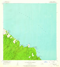
1957 Map of Keanae
USGS Topo · Published 1959About this map
The coastal village of Keanae sits prominently on its lava-formed peninsula, surrounded by the waters of the Pacific Ocean and the lush greenery of the Koolau Forest Reserve. In the late 1950s, this area of Maui was defined by its intricate water systems, including the Spreckels Ditch, Koolau Ditch, and Hamakua Ditch, which directed water through the mountainous terrain. Agricultural life was centered around the Keanae Homesteads and Wailua Homesteads, where traditional taro cultivation relied on the numerous streams and springs like Waiakuna Spring. Infrastructure such as the Keanae Powerhouse and several gaging stations reflect the managed hydraulics of the valley. The map also records essential community landmarks, including Keanae School, a local cemetery, and the winding route of the Hana Highway as it navigates the steep gulches and waterfalls like Waikani Falls and Keaku Falls.
Find a feature on this map
73 named features on this map. Tap any name to fly to it.
Don’t see what you’re looking for? This feature index may not catch every label — zoom into the map to look around manually.
Map Details
Editions of this 1957 Keanae Map
2 editions found
Other maps of this area

1954 · Maui
USGS Topo · 1:250,000

1957 · Kilohana
USGS Topo · 1:24,000

1957 · Hana
USGS Topo · 1:24,000

1957 · Haiku
USGS Topo · 1:24,000

1957 · Nahiku
USGS Topo · 1:24,000

1966 · Maui
USGS Topo · 1:250,000

1974 · Maui
USGS Topo · 1:250,000

1978 · Hana
USGS Topo · 1:24,000

1983 · Nahiku
USGS Topo · 1:24,000
1983 · Kilohana
USGS Topo · 1:24,000