
1978 Map of Hana
USGS Topo · Published 1981About this map
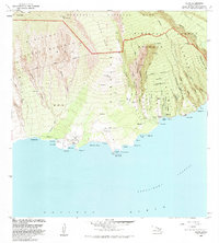
Hana sits along the eastern coastline of Maui in this late-1970s orthophoto survey, providing a rare aerial perspective on the region's topography before more modern development. This photographic map reveals the dramatic volcanic landscape, showing the transition from the rugged shoreline at Keakulikuli Pt. to the high interior elevations marked by cinder cones like Puu Hinai and Puu Puou. The complex drainage patterns of the Waihoi Valley are clearly visible, illustrating how the dense vegetation and terrain shaped the early layout of the settlement. Unlike traditional line-drawn maps, this image captures the literal texture of the land, from the breaking waves of the Pacific Ocean to the agricultural patches and forested ridges that defined the character of this isolated coastal community during the era.
Find a feature on this map
6 named features on this map. Tap any name to fly to it.
Don’t see what you’re looking for? This feature index may not catch every label — zoom into the map to look around manually.
Map Details
Editions of this 1978 Hana Map
This is the sole edition of this map. No revisions or reprints were ever made.
Other maps of this area

1954 · Maui
USGS Topo · 1:250,000

1957 · Kipahulu
USGS Topo · 1:24,000

1957 · Hana
USGS Topo · 1:24,000

1957 · Nahiku
USGS Topo · 1:24,000

1957 · Kaupo
USGS Topo · 1:24,000

1957 · Keanae
USGS Topo · 1:24,000

1966 · Maui
USGS Topo · 1:250,000

1974 · Maui
USGS Topo · 1:250,000

1983 · Nahiku
USGS Topo · 1:24,000
1983 · Kaupo
USGS Topo · 1:24,000