
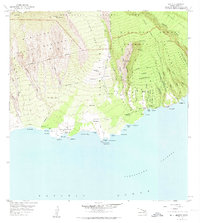
1957 Map of Kaupo
USGS Topo · Published 1959About this map
The dramatic southern slopes of Haleakala Crater descend toward the Alenuihaha Channel in this mid-century portrait of East Maui. This coastal landscape is defined by the massive breach of the Kaupo Gap, where the Kaupo Trail winds down from the high volcanic elevations into the fertile lower lands. The map documents the layout of the Kaupo Homesteads, including the Maalo Homesteads and Kalepa Homesteads, which are interspersed with significant ancient Hawaiian sites like Loaloa Heiau and Hale O Kane Heiau. Along the rugged shoreline, small maritime facilities and points of entry like Mokulau Landing and the Nuu (Site) reflect a history of coastal accessibility before the full modernization of the Piilani Highway. The network of Water Tanks and an aboveground pipeline illustrate the vital management of water resources across the gulches and ridges of the Kipahulu Forest Reserve.
Find a feature on this map
87 named features on this map. Tap any name to fly to it.
Don’t see what you’re looking for? This feature index may not catch every label — zoom into the map to look around manually.
Map Details
Editions of this 1957 Kaupo Map
2 editions found
Other maps of this area

1954 · Maui
USGS Topo · 1:250,000

1957 · Kilohana
USGS Topo · 1:24,000

1957 · Kipahulu
USGS Topo · 1:24,000

1957 · Hana
USGS Topo · 1:24,000

1957 · Lualailua Hills
USGS Topo · 1:24,000

1957 · Nahiku
USGS Topo · 1:24,000

1966 · Maui
USGS Topo · 1:250,000

1974 · Maui
USGS Topo · 1:250,000

1978 · Hana
USGS Topo · 1:24,000
1983 · Lualailua Hills
USGS Topo · 1:24,000