
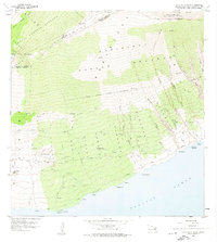
1957 Map of Lualailua Hills
USGS Topo · Published 1959About this map
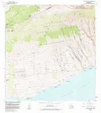
Haleakala National Park defines the northern reaches of this coastal landscape on Maui’s southern slope, where the volcanic terrain descends from the high peaks of Haupaakea Pk toward the Pacific Ocean. The map documents a sparsely settled region transitionally managed through several large forestry units, including the Kula Forest Reserve and Kahikinui Forest Reserve. Cultural landmarks are few but significant for local history, including the Kahikinui House and the CAA Repeater Sta located near the district boundary. The land is heavily dissected by deep drainages such as Waiopai Gulch and Manawainui Gulch, which cut through the volcanic soil towards prominent coastal markers like Nakaohu Pt. Transportation is limited primarily to the Piilani Highway and a network of jeep trails connecting isolated points like Hokukano and Manukani.
Find a feature on this map
54 named features on this map. Tap any name to fly to it.
Don’t see what you’re looking for? This feature index may not catch every label — zoom into the map to look around manually.
Map Details
Editions of this 1957 Lualailua Hills Map
2 editions found
Other maps of this area

1954 · Maui
USGS Topo · 1:250,000

1954 · Puu O Kali
USGS Topo · 1:24,000

1954 · Makena
USGS Topo · 1:24,000

1957 · Kilohana
USGS Topo · 1:24,000

1957 · Nahiku
USGS Topo · 1:24,000

1957 · Kaupo
USGS Topo · 1:24,000

1966 · Maui
USGS Topo · 1:250,000

1974 · Maui
USGS Topo · 1:250,000
1983 · Lualailua Hills
USGS Topo · 1:24,000

1983 · Nahiku
USGS Topo · 1:24,000