Old Maps of Heipa District for Hiking & Exploration
Hike through history with 116 historic maps of Heipa District. Explore old trails, ghost towns, and forgotten backroads — perfect for outdoor adventurers and local explorers.
- Rediscover forgotten places: Map out old mining camps, roads, and footpaths that no longer exist on modern maps.
- Layer with modern tools: Combine with LiDAR or satellite views to plan hikes through historical terrain.
- Made for exploration: Popular among hikers, overlanders, and local history lovers.
Use these maps to find adventure and explore the hidden past of Heipa District.
Heipa District maps
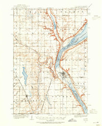
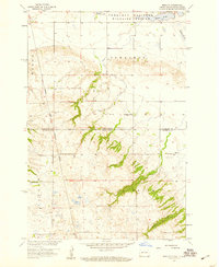
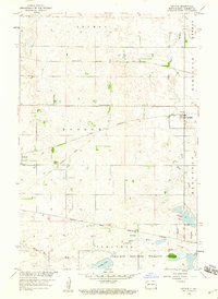
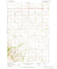
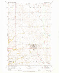
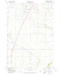
(116)- 1907 Map of Wyndmere
 1907 Wyndmere1907 Print · USGSRichland and Sargent counties are seen here in the early 1900s during the height of the prairie railroad boom. Genealogists and historians can trace the paths of five different rail lines serving early towns like Milnor, Wyndmere, and Sandoun Mc Leod P O.2 unique versions available
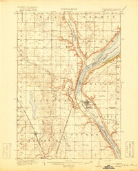
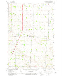
 - 1916 Map of Peever, 1954 Print
 1916 Peever1954 Print · USGSThe borderlands of South Dakota and Minnesota come alive in this survey of the early twentieth century. Genealogists and local historians can trace the paths of the Great Northern railroad and locate rural landmarks like Windom School, Peever, and the Erdman School.
 - 1917 Map of New Effington
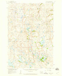
 1917 New Effington1917 Print · USGSThe Dakota borderlands come alive in this survey from the mid-1910s, capturing the early rail-and-reservation era. Genealogists can locate family-named landmarks like Shafts School and Wymen School along the Minneapolis St Paul and Sault Ste Marie line.2 unique versions available
 - 1918 Map of Peever
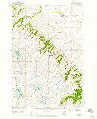
 1918 Peever1918 Print · USGSThe borderlands of South Dakota and Minnesota are captured here during the First World War, centered on the strategic divide at Browns Valley. Genealogists and local historians can trace rural school locations like Morehead School and Becker School alongside the tracks of the Great Northern railroad.4 unique versions available
 - 1953 Map of Milbank, 1958 Print
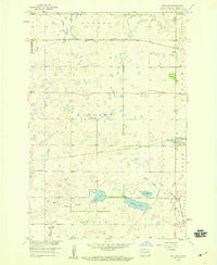
 1953 Milbank1958 Print · USGSThe tri-state border region of South Dakota, North Dakota, and Minnesota is shown here during the early fifties, a landscape defined by glacial lakes and the Sisseton Indian Reservation. Researchers can trace the legacy of the western railroads, locating old stops along the Great Northern and settlements like Milbank, Webster, and Sisseton.3 unique versions available
 - 1953 Map of Fargo, 1965 Print
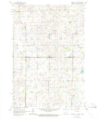
 1953 Fargo1965 Print · USGSThe Red River Valley in the mid-fifties was a bustling rail and agricultural corridor during a period of steady prairie growth. Genealogists and historians can trace the intricate rail networks of the Great Northern and Soo Line connecting local hubs like Casselton and Wahpeton.2 unique versions available
 - 1956 Map of Fargo
 1956 Fargo1956 Print · USGSThe Red River Valley's agricultural heartland is documented here in the mid-fifties as the rail-and-road network expanded across the plains. Genealogists can trace family roots through numerous small railroad towns and local landmarks like Casselton, Sheyenne Valley Church, and Sisseton Indian Res.
 - 1958 Map of Milbank
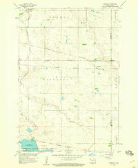
 1958 Milbank1958 Print · USGSThe northern Great Plains in the late fifties show a landscape of glacial lakes and reservation lands shaped by the Great Northern railroad. Genealogists and local historians can trace the grid of settlements from Britton to Milbank and locate landmarks like Enemy Swim Lake and the Sisseton Indian Reservation.
 - 1958 Map of Hillhead, 1959 Print
 1958 Hillhead1959 Print · USGSThe glacial hills of Marshall County come alive in this late 1950s survey of the prairie pothole region. Genealogists and local historians can trace the Old Fort Sisseton Military Reservation Boundary and locate rural landmarks like Trondhjem Ch and Hillhead.
 - 1958 Map of Veblen, 1959 Print
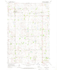
 1958 Veblen1959 Print · USGSMarshall County in the late fifties shows the town of Veblen at the foot of the Coteau Des Prairies. Family historians can trace rural roots at St Matthew Cem, Zion Ch, and the site of School No 1 (Abandoned).
 - 1958 Map of Marlow, 1959 Print
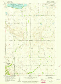
 1958 Marlow1959 Print · USGSSargent County and the South Dakota borderlands are shown in the late fifties as a landscape of prairie wetlands and reservation boundaries. Genealogists can locate family sites near Marlow, the Emmanuel Ch, and multiple locations of School No 1.2 unique versions available
 - 1958 Map of Rutland, 1959 Print
 1958 Rutland1959 Print · USGSSargent County is captured during the late fifties as a vital rail junction centered on the town of Rutland. Genealogists and local historians can trace the foundations of the community through Trinity Cem, Rutland Sch, and the winding Wild Rice River.2 unique versions available
 - 1958 Map of Veblen NE, 1959 Print
 1958 Veblen NE1959 Print · USGSThe Dakota borderlands come alive in this late-fifties survey of a landscape shaped by glacial waters and iron rails. Genealogists can locate rural landmarks like Palestina Ch and Bergen Cem or trace the Minneapolis St Paul and Sault Ste Marie line.3 unique versions available
 - 1958 Map of Geneseo, 1960 Print
 1958 Geneseo1960 Print · USGSSargent County prairie life in the late fifties centered on the rail junction at Geneseo and the winding Wild Rice River. Genealogists and local historians can trace the Sisseton Indian Reservation Boundary and locate St Martin Cem or the rural School No 3.
 - 1958 Map of Cayuga, 1960 Print
 1958 Cayuga1960 Print · USGSSargent County in the late fifties reveals a landscape shaped by competing rail lines and sprawling wildlife refuges. Genealogists and local historians can trace the foundations of Cayuga and Rutland alongside rural landmarks like Nordland Cem.
 - 1964 Map of Claire City NE, 1966 Print
 1964 Claire City NE1966 Print · USGSRichland and Roberts counties meet along the Dakotas' border in the mid-1960s, a landscape defined by prairie wetlands and small rural parishes. Genealogists can locate family landmarks like St Pauls Cem, Ferkingstad Ch, and School No 2.
 - 1964 Map of Claire City NW, 1966 Print
 1964 Claire City NW1966 Print · USGSCrossing the North Dakota-South Dakota border in the mid-1960s, this area shows the intersection of the Sisseton Indian Reservation and various county lines. Genealogists can locate family landmarks like Bergen Ch Cem and the Nidaros Ch among the prairie sloughs.
 - 1964 Map of Claire City, 1966 Print
 1964 Claire City1966 Print · USGSNortheastern South Dakota's glacial prairie and rail-side settlements are captured here in the mid-1960s. Genealogists and local historians can trace the foundations of Claire City and Hammer, along with several rural burial grounds like St Boniface Cem.
 - 1964 Map of Claire City SW, 1967 Print
 1964 Claire City SW1967 Print · USGSThe northern Roberts County prairie meets the Marshall County line in the mid-1960s, showing a landscape defined by glacial coulees and the SOO LINE railroad. Genealogists can locate family landmarks like Bethel Ch, Mayason Ch, and a local Cem.
 - 1970 Map of Whitestone Lake, 1973 Print
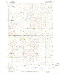
 1970 Whitestone Lake1973 Print · USGSThe Sisseton Indian Reservation during the 1970s shows a landscape of deep coulees and prairie lakes on the Coteau des Prairies. Researchers can trace rural cemetery sites like Spring Valley Cem and Roy Cem or locate local landmarks like St Benedict Ch.
 - 1970 Map of Sisseton, 1973 Print
 1970 Sisseton1973 Print · USGSThe Sisseton Indian Reservation during the early 1970s shows a landscape of rail-linked prairie towns and local landmarks. Trace family history at Saron Ch Cem or follow the Chicago Milwaukee St Paul and Pacific line past Dry Wood Lake.
 - 1970 Map of South Red Iron Lake, 1973 Print
 1970 South Red Iron Lake1973 Print · USGSMarshall County's lake country is captured here during the 1970s, showcasing the high density of glacial basins within the Sisseton Indian Reservation. Researchers can locate the Old Eden Cem and trace the drainage patterns through Meyer Slough and South Red Iron Lake.
 - 1970 Map of Lake City, 1973 Print
 1970 Lake City1973 Print · USGSThe glacial lake country of Marshall County comes into focus in this 1970s survey. Researchers can trace the Fort Sisseton Military Reservation Boundary Line and locate burials at St Joseph Cem or Lake City Cem.
 - 1971 Map of Peever NW, 1974 Print
 1971 Peever NW1974 Print · USGSRoberts County in the early seventies shows a landscape of prairie potholes and agricultural townships. Researchers can trace the Little Minnesota River and find local landmarks like Concordia Pioneer Ch and the Townhall.
 - 1972 Map of New Effington NE, 1974 Print
 1972 New Effington NE1974 Print · USGSThe North Dakota and South Dakota borderlands are captured here in the early 1970s, split between the plains of Greendale and Victor. Researchers can locate rural landmarks like Old Brandvold Cem and the Soo Line rail corridor.
Showing maps 1-25 of 116
Top cities near Heipa District
- Sisseton historical maps
- Lidgerwood historical maps
- Long Hollow historical maps
- Veblen historical maps
- Claire City historical maps
- Cayuga historical maps
Top neighborhoods of Heipa District
- Marboe Township historical maps
- Hammer historical maps
- Dahlberg historical maps
- Hillhead historical maps
- Tewaukon Township historical maps
- Marlow historical maps
See more
Frequently asked questions
- What are the different types of historical maps available for Heipa District?
- What is the oldest map of Heipa District?
- Where can I purchase historical maps of Heipa District for my home or office?
- Where can I download high-res historical maps of Heipa District?
- Are there historical topographic maps available for Heipa District?
- Is there historical aerial imagery available for Heipa District?
- Where are historical maps of Heipa District sourced from?