1900s (20th Century) Maps of Bannock County, Idaho
Explore 63 historic maps of Bannock County from the 1900s (20th Century). These maps offer a rare glimpse into what life looked like during the 1900s — showing old roads, neighborhoods, homes, and landmarks that have changed or disappeared over time.
Whether you're researching your family's past, planning a metal detecting trip, or studying how Bannock County's landscape evolved across the 1900s, these high-resolution maps are a powerful tool for exploring the history of this region.
- Focus on a specific era: All maps on this page are from the 1900s, giving you a focused view of this time period.
- See what’s changed: Compare century-old streets, trails, and buildings to today's modern landscape using overlays and satellite layers.
- Research with precision: Use these maps for genealogy, historical research, land use analysis, or educational projects.
- View, download, or print: Maps are fully viewable online in high resolution, and can be downloaded or printed for your own records.
Start exploring Bannock County's history through authentic maps from the 1900s. This is your window into the past.
Bannock County, ID maps
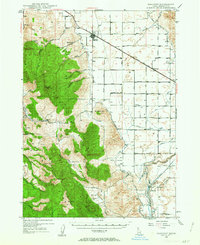
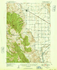
(63)- 1915 Map of Preston
 1915 Preston1915 Print · USGSCovers Bannock County, including Preston, Franklin, and other nearby areas2 unique versions available
 - 1918 Map of Preston
 1918 Preston1918 Print · USGSCovers Bannock County, including Preston, Franklin, and other nearby areas2 unique versions available
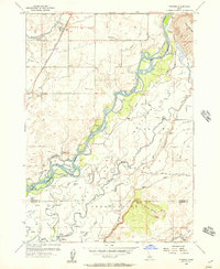
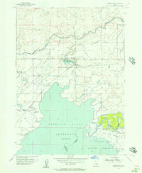
 - 1934 Map of American Falls, 1957 Print
 1934 American Falls1957 Print · USGSCovers Bannock County, including American Falls, Aberdeen, and other nearby areas
 - 1934 Map of Michaud, 1957 Print
 1934 Michaud1957 Print · USGSCovers Bannock County, including Pocatello, Arbon Valley, and other nearby areas
 - 1936 Map of American Falls
 1936 American Falls1936 Print · USGSCovers Bannock County, including American Falls, Aberdeen, and other nearby areas
 - 1937 Map of Pocatello
 1937 Pocatello1937 Print · USGSCovers Bannock County, including Pocatello, Inkom, and other nearby areas3 unique versions available
 - 1937 Map of Michaud
 1937 Michaud1937 Print · USGSCovers Bannock County, including Pocatello, Arbon Valley, and other nearby areas
 - 1940 Map of Blackfoot, 1958 Print
 1940 Blackfoot1958 Print · USGSCovers Bannock County, including Blackfoot, Gibson, and other nearby areas
 - 1943 Map of Blackfoot
 1943 Blackfoot1943 Print · USGSCovers Bannock County, including Blackfoot, Gibson, and other nearby areas2 unique versions available
 - 1944 Map of Pocatello
 1944 Pocatello1944 Print · USGSCovers Bannock County, including Pocatello, Inkom, and other nearby areas
 - 1948 Map of Bancroft, 1963 Print
 1948 Bancroft1963 Print · USGSCovers Bannock County, including Lava Hot Springs, Bancroft, and other nearby areas2 unique versions available
 - 1949 Map of Bancroft
 1949 Bancroft1949 Print · USGSCovers Bannock County, including Lava Hot Springs, Bancroft, and other nearby areas
 - 1954 Map of Pocatello, 1963 Print
 1954 Pocatello1963 Print · USGSCovers Bannock County, including Pocatello, Burley, and other nearby areas4 unique versions available
 - 1955 Map of Yandell Springs, 1957 Print
 1955 Yandell Springs1957 Print · USGSCovers Bannock County, including Alridge, Bingham County, and other nearby areas
 - 1955 Map of Pingree, 1957 Print
 1955 Pingree1957 Print · USGSCovers Bannock County, including Fort Hall, Pingree, and other nearby areas4 unique versions available
 - 1955 Map of Springfield, 1957 Print
 1955 Springfield1957 Print · USGSCovers Bannock County, including Springfield, Sterling, and other nearby areas3 unique versions available
 - 1955 Map of Idaho Falls, 1963 Print
 1955 Idaho Falls1963 Print · USGSCovers Bannock County, including Idaho Falls, Blackfoot, and other nearby areas5 unique versions available
 - 1955 Map of Preston, 1968 Print
 1955 Preston1968 Print · USGSCovers Bannock County, including Preston, Soda Springs, and other nearby areas3 unique versions available
 - 1958 Map of Idaho Falls
 1958 Idaho Falls1958 Print · USGSCovers Bannock County, including Idaho Falls, Blackfoot, and other nearby areas2 unique versions available
 - 1958 Map of Pocatello
 1958 Pocatello1958 Print · USGSCovers Bannock County, including Pocatello, Burley, and other nearby areas2 unique versions available
 - 1958 Map of Preston
 1958 Preston1958 Print · USGSCovers Bannock County, including Preston, Soda Springs, and other nearby areas2 unique versions available
 - 1962 Map of Preston
 1962 Preston1962 Print · USGSCovers Bannock County, including Preston, Soda Springs, and other nearby areas
 - 1968 Map of Malad Summit, 1971 Print
 1968 Malad Summit1971 Print · USGSCovers Bannock County, including Oneida County, Franklin County, and other nearby areas2 unique versions available
 - 1968 Map of Oxford, 1971 Print
 1968 Oxford1971 Print · USGSCovers Bannock County, including Oxford, Oneida County, and other nearby areas
 - 1968 Map of Dairy Creek, 1971 Print
 1968 Dairy Creek1971 Print · USGSCovers Bannock County, including Power County, Oneida County, and other nearby areas
Showing maps 1-25 of 63
Top cities of Bannock County
- Pocatello historical maps
- McCammon historical maps
- Inkom historical maps
- Downey historical maps
- Lava Hot Springs historical maps
- Arimo historical maps
Frequently asked questions
- What are the different types of historical maps available for Bannock County?
- What is the oldest map of Bannock County?
- Where can I purchase historical maps of Bannock County for my home or office?
- Where can I download high-res historical maps of Bannock County?
- Are there historical topographic maps available for Bannock County?
- Is there historical aerial imagery available for Bannock County?
- Where are historical maps of Bannock County sourced from?