Old Maps of Bannock County, Idaho for Academic Research
Study the evolution of Bannock County with 248 high-resolution historic maps. Whether you're teaching, researching, or modeling changes in land use, these maps provide essential visual documentation of urban, environmental, and geographic change.
- Analyze long-term change: Track patterns in development, transportation, and natural features.
- Ideal for environmental or urban studies: Support academic projects with primary historical map data.
- Use in the classroom or lab: Educators and researchers rely on these maps to bring historical context to life.
These maps are a powerful tool for teaching, research, and visualizing how Bannock County has changed over the decades.
Bannock County, ID maps
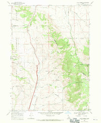
(248)- 1915 Map of Preston
 1915 Preston1915 Print · USGSSoutheastern Idaho and northern Utah are defined by their river valleys and early irrigation networks during the mid-1910s. Genealogists can locate family landmarks like the Thatcher Meetinghouse, Egypt School, and the path of the Oregon Short Line.2 unique versions available
 - 1918 Map of Preston
 1918 Preston1918 Print · USGSSouthern Idaho and northern Utah are captured just before the close of the Great War, showing a landscape of burgeoning farm towns and irrigation canals. Researchers can trace the Oregon Short Line to early settlements like Preston or locate rural landmarks like the Thatcher Meetinghouse and Egypt School.2 unique versions available
 - 1934 Map of American Falls, 1957 Print
 1934 American Falls1957 Print · USGSThe Snake River region in the mid-1930s shows a landscape of massive water projects and ranching roots. Genealogists and historians can trace the Old Oregon Trail, locate remote rural schools like Mt Hope Sch, and see the early footprint of the American Falls Dam.
 - 1934 Map of Michaud, 1957 Print
 1934 Michaud1957 Print · USGSThe Fort Hall Indian Reservation was undergoing significant changes in the 1930s as the American Falls Reservoir reshaped the valley. Genealogists and historians can trace the paths of the Oregon Trail, locate the Indian Cem, and find old rail stops at Schiller and Michaud.
 - 1936 Map of American Falls
 1936 American Falls1936 Print · USGSPower and Bingham counties are captured in the mid-1930s, showing the early years of the massive reservoir on the Snake River. Genealogists and historians can trace family-named sites like Kerr Ranch and a network of schools including Williams Sch and Range Sch.
 - 1937 Map of Pocatello
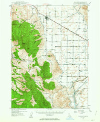
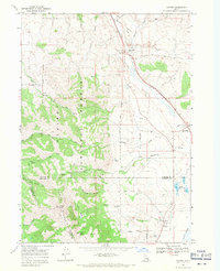
 1937 Pocatello1937 Print · USGSBannock County is captured in the late 1930s as a burgeoning rail and highway crossroads along the Portneuf River. Genealogists can locate family landmarks in old Alameda, trace the Fort Hall Mine, or find rural school sites like Blackrock Sch.3 unique versions available
 - 1937 Map of Michaud
 1937 Michaud1937 Print · USGSThe Fort Hall Indian Reservation and its mid-century transportation networks are documented here just as the aviation age was taking flight. Genealogists and historians can trace family-named sites and early infrastructure like the Indian School, Indian Cem, and the path of the Old Oregon Trail.
 - 1940 Map of Blackfoot, 1958 Print
 1940 Blackfoot1958 Print · USGSBingham County at the dawn of the 1940s reveals a landscape defined by the Snake River and a vast irrigation network. Genealogists and historians can trace the Fort Hall Indian Reservation boundaries, find School No 12, and locate the Indian Agency and Ross Fork Indian Sch.
 - 1943 Map of Blackfoot
 1943 Blackfoot1943 Print · USGSSoutheastern Idaho's river valleys and irrigation networks are on full display in the early 1940s, centered on the confluence of the Snake River and Blackfoot River. Genealogists and historians can trace family-named waterworks like Wearyrick Ditch and explore the historic layout of the Fort Hall Indian Reservation and Blackfoot.2 unique versions available
 - 1944 Map of Pocatello
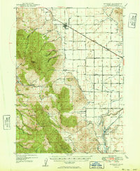
 1944 Pocatello1944 Print · USGSBannock County and the Fort Hall Indian Reservation are captured here in the years leading up to the second World War. Researchers can trace the early streets of Pocatello and Alameda, or locate rural landmarks like the Portneuf Sch and the Fort Hall Mine.
 - 1948 Map of Bancroft, 1963 Print
 1948 Bancroft1963 Print · USGSBancroft and the Gentile Valley are captured here during the post-war era of hydroelectric and agricultural expansion. Local historians can trace the irrigation canals and power plants along the Bear River, alongside vanished landmarks like the Telluride Sch and Leadville Mine.2 unique versions available
 - 1949 Map of Bancroft
 1949 Bancroft1949 Print · USGSBancroft and the Gentile Valley are captured here in the late 1940s, showing a landscape defined by the Union Pacific rail line and early hydroelectric power. Researchers can locate the Leadville Mine, the Telluride School, and numerous family-named landmarks like Kackley Spr and Barfuss Road.
 - 1954 Map of Pocatello, 1963 Print
 1954 Pocatello1963 Print · USGSSoutheast Idaho in the mid-1950s reveals a landscape shaped by massive water reclamation and mountain forests. Researchers can trace the development of the Fort Hall Indian Reservation or locate specific landmarks like the Arbon P O and Emerson School.4 unique versions available
 - 1955 Map of Yandell Springs, 1957 Print
 1955 Yandell Springs1957 Print · USGSBingham County in the mid-1950s was a landscape of high-country springs and developing phosphate mines. Researchers can trace the Fort Hall Indian Reservation boundary, locate the Westvaco Mine, and find the Fort Hall No 2 Historic Site.
 - 1955 Map of Pingree, 1957 Print
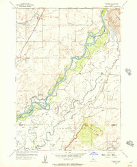 1955 Pingree1957 Print · USGSThe Snake River plain in the mid-fifties shows a landscape of deep historical layers, where the Route of Old Oregon Trail crosses the Fort Hall Indian Reservation. Trace early transit and water rights through the Union Pacific tracks, local cemeteries, and the Aberdeen Springfield Canal.4 unique versions available
 - 1955 Map of Springfield, 1957 Print
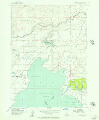 1955 Springfield1957 Print · USGSBingham County agriculture and river life meet in the mid-1950s near the northern reaches of the American Falls Reservoir. Researchers can trace the path of the Oregon Trail past the Fort Hall Historic Monument or locate family roots in Springfield and Sterling.3 unique versions available
 - 1955 Map of Idaho Falls, 1963 Print
 1955 Idaho Falls1963 Print · USGSThe Snake River Plain and its surrounding volcanic peaks are captured in the late fifties, showing the region's unique mix of nuclear research and high-desert ranching. Trace the industrial footprint of the National Reactor Testing Station or find old mining sites like Empire Mine.5 unique versions available
 - 1955 Map of Preston, 1968 Print
 1955 Preston1968 Print · USGSSoutheast Idaho and western Wyoming are shown in detail during the mid-fifties, from the high Bear River Range to the Green River Basin. Genealogists and collectors can trace the Union Pacific RR through historic towns like Preston, Montpelier, and Afton.3 unique versions available
 - 1958 Map of Idaho Falls
 1958 Idaho Falls1958 Print · USGSEastern Idaho in the late fifties showcases the rapid expansion of agricultural and scientific outposts across its volcanic plains. Researchers can locate remote sites like Atomic City, mineral interests at White Knob Mine, and the cultural grounds of St Marys Mission.2 unique versions available
 - 1958 Map of Pocatello
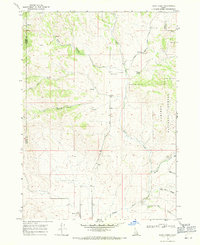
 1958 Pocatello1958 Print · USGSSoutheastern Idaho in the late fifties was a landscape of expanding reservoirs and historic trails. Genealogists and historians can trace the Old Oregon Trail, locate the Bannock Creek Indian Day School, and study the many Union Pacific rail sidings.2 unique versions available
 - 1958 Map of Preston
 1958 Preston1958 Print · USGSThe high valleys of the Idaho and Wyoming borderlands are captured here in the late fifties, showcasing a landscape of mountain ranching and phosphate mining. Genealogists and historians can locate early settlements like Chesterfield and Bedford or trace the Union Pacific rail lines serving Cokeville.2 unique versions available
 - 1962 Map of Preston
 1962 Preston1962 Print · USGSSoutheast Idaho and the Wyoming borderlands are captured here in the early sixties, a time of thriving agricultural valleys and mountain ranching. Researchers can trace the Union Pacific rail lines and find legacy settlements like Montpelier, Afton, and Preston.
 - 1968 Map of Malad Summit, 1971 Print
 1968 Malad Summit1971 Print · USGSThe high pass at Malad Summit served as a vital corridor through the Idaho mountains during the late 1960s. Researchers can locate remote resource sites like a Mill and Mine, and trace old routes through the Caribou National Forest via a pack trail.2 unique versions available
 - 1968 Map of Oxford, 1971 Print
 1968 Oxford1971 Print · USGSThe Marsh Valley corridor comes to life in this late 1960s survey, showing the vital transit and water networks of southern Idaho. Trace family roots at the Oxford Cem and explore the historic geography of Red Rock Pass and Swanlake.
 - 1968 Map of Dairy Creek, 1971 Print
 1968 Dairy Creek1971 Print · USGSOneida County's high country is captured here in the late sixties as a landscape of cattle-range canyons and mountain springs. Genealogists and historians can trace family-named landmarks like Harold Johns Canyon, the waters of Indian Mill Creek, and early routes like the Pack Trail.
Showing maps 1-25 of 248
Top cities of Bannock County
- Pocatello historical maps
- McCammon historical maps
- Inkom historical maps
- Downey historical maps
- Lava Hot Springs historical maps
- Arimo historical maps
Frequently asked questions
- What are the different types of historical maps available for Bannock County?
- What is the oldest map of Bannock County?
- Where can I purchase historical maps of Bannock County for my home or office?
- Where can I download high-res historical maps of Bannock County?
- Are there historical topographic maps available for Bannock County?
- Is there historical aerial imagery available for Bannock County?
- Where are historical maps of Bannock County sourced from?