1960s Maps of Bannock County, Idaho
Explore 22 historic maps of Bannock County from the 1960s. These maps offer a rare glimpse into what life looked like during the 1960s — showing old roads, neighborhoods, homes, and landmarks that have changed or disappeared over time.
Whether you're researching your family's past, planning a metal detecting trip, or studying how Bannock County's landscape evolved across the 1960s, these high-resolution maps are a powerful tool for exploring the history of this region.
- Focus on a specific era: All maps on this page are from the 1960s, giving you a focused view of this time period.
- See what’s changed: Compare century-old streets, trails, and buildings to today's modern landscape using overlays and satellite layers.
- Research with precision: Use these maps for genealogy, historical research, land use analysis, or educational projects.
- View, download, or print: Maps are fully viewable online in high resolution, and can be downloaded or printed for your own records.
Start exploring Bannock County's history through authentic maps from the 1960s. This is your window into the past.
Bannock County, ID maps
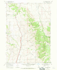
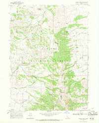
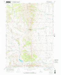
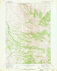
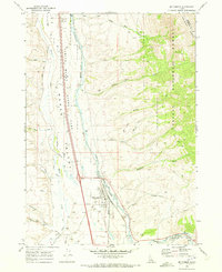
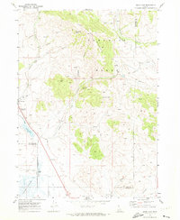
(22)- 1962 Map of Preston
 1962 Preston1962 Print · USGSSoutheast Idaho and the Wyoming borderlands are captured here in the early sixties, a time of thriving agricultural valleys and mountain ranching. Researchers can trace the Union Pacific rail lines and find legacy settlements like Montpelier, Afton, and Preston.
 - 1968 Map of Malad Summit, 1971 Print
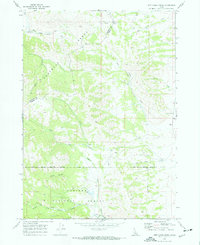
 1968 Malad Summit1971 Print · USGSThe high pass at Malad Summit served as a vital corridor through the Idaho mountains during the late 1960s. Researchers can locate remote resource sites like a Mill and Mine, and trace old routes through the Caribou National Forest via a pack trail.2 unique versions available
 - 1968 Map of Oxford, 1971 Print
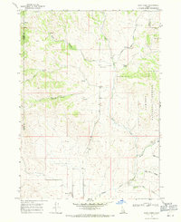
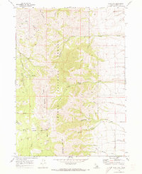
 1968 Oxford1971 Print · USGSThe Marsh Valley corridor comes to life in this late 1960s survey, showing the vital transit and water networks of southern Idaho. Trace family roots at the Oxford Cem and explore the historic geography of Red Rock Pass and Swanlake.
 - 1968 Map of Dairy Creek, 1971 Print
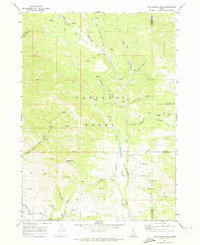
 1968 Dairy Creek1971 Print · USGSOneida County's high country is captured here in the late sixties as a landscape of cattle-range canyons and mountain springs. Genealogists and historians can trace family-named landmarks like Harold Johns Canyon, the waters of Indian Mill Creek, and early routes like the Pack Trail.
 - 1968 Map of Downey West, 1971 Print
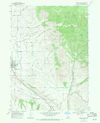
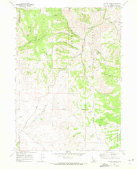
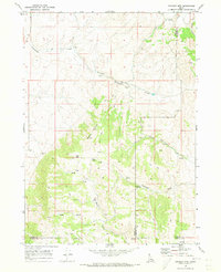
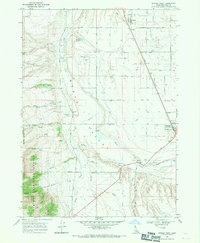 1968 Downey West1971 Print · USGSBannock County's Marsh Valley is seen here in the late sixties as a thriving rail and irrigation corridor. Trace family history at the Woodland Cem or explore the infrastructure around Downey, including the Bannock County Fairgrounds and the Union Pacific line.2 unique versions available
 - 1968 Map of Wakley Peak, 1971 Print
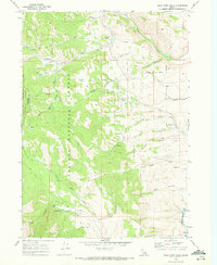
 1968 Wakley Peak1971 Print · USGSHigh ridges along the Oneida and Bannock County border appear here as they were in the late sixties. Researchers can trace the legacy of resource extraction and ranching through several Mines, Shrives Road, and family-named landmarks like Perry Canyon.2 unique versions available
 - 1968 Map of Downey East, 1971 Print
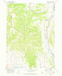
 1968 Downey East1971 Print · USGSBannock County was a corridor of rail and road travel in the late sixties, centered on the irrigation and ranching of Marsh Valley. Genealogists and historians can trace the foundations of Downey, locate the Grant Ward Cem, and find the historic Downata Hot Springs.2 unique versions available
 - 1968 Map of Elkhorn Peak, 1971 Print
 1968 Elkhorn Peak1971 Print · USGSThe high country of Oneida County is captured here in the late sixties, showcasing the rugged drainage systems above the Malad Valley. Researchers can trace old forest service routes and water works like the Summit Guard Sta, Secret Spring Aqueduct, and Birch Spring.
 - 1968 Map of Bear Camp Gulch, 1972 Print
 1968 Bear Camp Gulch1972 Print · USGSThe Portneuf Range of southeastern Idaho is captured here in the late sixties, showing a wilderness of national forest land and mountain watersheds. Researchers can locate remote administrative sites like the Toponce Guard Station and livestock markers such as the Pebble Cow Camp.
 - 1968 Map of Hawkins, 1972 Print
 1968 Hawkins1972 Print · USGSBannock County rangelands and high mountain ridges are documented here in the late sixties, centered on the Hawkins Basin and the Caribou National Forest. Researchers can trace the path of the Emigrant Trail or locate family sites like the Robin Cemetery and the settlement of Hawkins.2 unique versions available
 - 1968 Map of Clifton Creek, 1972 Print
 1968 Clifton Creek1972 Print · USGSPower and Bannock Counties in the late sixties remain a landscape of high-country trails and forest management. Researchers can trace the development of local recreation and transit at the Bannock Guard Station, Crystal, and the Bannock Highway.
 - 1968 Map of Lava Hot Springs, 1972 Print
 1968 Lava Hot Springs1972 Print · USGSSoutheastern Idaho's canyon country comes into focus in the late 1960s as the town of Lava Hot Springs develops along the Union Pacific rail line. Genealogists and local historians can trace family-named landmarks like Christenson Spring, Chatterton Road, and the Lava Hot Springs Cem.2 unique versions available
 - 1968 Map of Arimo, 1972 Print
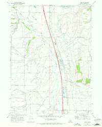 1968 Arimo1972 Print · USGSBannock County is seen here in the late sixties as a vital transport corridor centered on the Marsh Valley settlements. Researchers can locate the Marsh Center (Site), trace the Robin Old Indian Treaty Road, and find family sites near Arimo.2 unique versions available
 - 1968 Map of South Putnam Mtn, 1972 Print
 1968 South Putnam Mtn1972 Print · USGSHigh in the Idaho backcountry during the late sixties, this terrain covers the intersection of tribal and national forest lands. Local researchers can trace old travel routes like Mc Nab Road and the Buck Skin Pack Trail near Barclay and Mt Putnam.
 - 1968 Map of Bonneville Peak, 1972 Print
 1968 Bonneville Peak1972 Print · USGSInkom and the surrounding Bannock County highlands are captured here in the late sixties as the rail and river corridor meets the mountains. Genealogists and hikers can trace old family-named routes and landmarks like Inkom Cem, Bonneville Peak, and the Inman Pass Trail.2 unique versions available
 - 1968 Map of Bradley Mtn, 1973 Print
 1968 Bradley Mtn1973 Print · USGSPower and Bannock counties appear here in the late sixties as a high-altitude ranching and mining landscape. Researchers can trace the network of Jeep Trails connecting remote Mines, Eagle Pass, and numerous named water sources like Bull Spring.2 unique versions available
 - 1968 Map of Haystack Mtn, 1973 Print
 1968 Haystack Mtn1973 Print · USGSThe high Portneuf Range and river valley are captured here in the late sixties, highlighting the intersection of federal forest lands and historic tribal borders. You can trace the Old Indian Treaty Bdy across the hills and locate landmarks like Pebble, the Robbers Roost Trail, and the river's Falls.
 - 1968 Map of Mc Cammon, 1973 Print
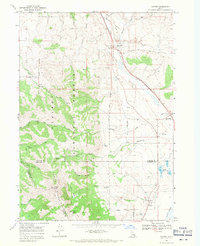
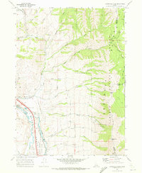
 1968 Mc Cammon1973 Print · USGSSoutheast Idaho's high valley landscape comes to life in the late sixties, centered on the railroad crossroads of McCammon. Trace the historic Old Indian Treaty Bdy and find unique landmarks like the Petroglyphs near the Portneuf River.2 unique versions available
 - 1968 Map of Jeff Cabin Creek, 1973 Print
 1968 Jeff Cabin Creek1973 Print · USGSCaribou County and the high Portneuf Range are documented here in the late sixties, showing the vital connection between water and western travel. You can trace the historic Oregon Trail, locate the Faulkner Ranch, and study the original Fort Hall Indian Reservation Boundary.2 unique versions available
 - 1968 Map of Scout Mtn, 1973 Print
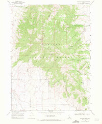
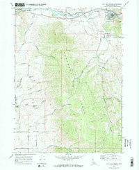
 1968 Scout Mtn1973 Print · USGSBannock County's high-elevation terrain is shown in detail during the late sixties, highlighting the rugged slopes of the Caribou National Forest. Trace recreational landmarks like Camp Tendoy and Scout Mtn Campground, or follow the remote paths of the South Fork Marsh Creek.2 unique versions available
 - 1969 Map of Cottonwood Peak, 1973 Print
 1969 Cottonwood Peak1973 Print · USGSThe Portneuf Range and its high-elevation canyons define this corner of Idaho in the late sixties. Researchers can trace historic water routes and mountain access trails from Cottonwood Peak to the Treasureton Canal and the cattle-grazing grounds of Hog Wallow.2 unique versions available
 - 1969 Map of Swan Lake, 1973 Print
 1969 Swan Lake1973 Print · USGSIn the high country of Southeast Idaho during the late sixties, the railroad dictated the rhythm of rural life between the Portneuf Range and Oxford Slough. Genealogists and historians can trace the local infrastructure around Swanlake and Swan Lake, including irrigation canals and remote mountain springs.2 unique versions available
End of results
Showing maps 1-22 of 22
Top cities of Bannock County
- Pocatello historical maps
- McCammon historical maps
- Inkom historical maps
- Downey historical maps
- Lava Hot Springs historical maps
- Arimo historical maps
Frequently asked questions
- What are the different types of historical maps available for Bannock County?
- What is the oldest map of Bannock County?
- Where can I purchase historical maps of Bannock County for my home or office?
- Where can I download high-res historical maps of Bannock County?
- Are there historical topographic maps available for Bannock County?
- Is there historical aerial imagery available for Bannock County?
- Where are historical maps of Bannock County sourced from?