
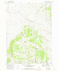
1968 Map of Bradley Mtn
USGS Topo · Published 1973About this map
Bradley Mountain rises as the central landmark of this high-altitude landscape on the borders of Power, Bannock, and Oneida counties. Surveyed in the late 1960s, the terrain is characterized by a sparse network of Jeep Trails and ranching infrastructure, including scattered Storage Bins and watering points such as Mud Spring, Bull Spring, and Hawkins Spring. The presence of Mines in the southwestern quadrant and a Radio Tower in the northeast suggests a landscape defined by natural resource extraction and early telecommunications.
Find a feature on this map
22 named features on this map. Tap any name to fly to it.
Don’t see what you’re looking for? This feature index may not catch every label — zoom into the map to look around manually.
Map Details
Editions of this 1968 Bradley Mtn Map
2 editions found
Other maps of this area

1938 · Pauline
USGS Topo · 1:48,000

1944 · Arbon
USGS Topo · 1:62,500

1954 · Pocatello
USGS Topo · 1:250,000

1958 · Pocatello
USGS Topo · 1:250,000

1968 · Dairy Creek
USGS Topo · 1:24,000

1968 · Wakley Peak
USGS Topo · 1:24,000

1968 · Hawkins
USGS Topo · 1:24,000

1968 · Clifton Creek
USGS Topo · 1:24,000
1968 · Scout Mtn
USGS Topo · 1:24,000
1971 · Flatiron Hill
USGS Topo · 1:24,000