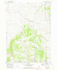
1968 Map of Bradley Mtn
USGS Topo · Published 1982About this map
Bradley Mountain dominates the central landscape of this Idaho interior, where the boundaries of Power, Bannock, and Oneida counties converge. Mapped in the late 1960s, the terrain is defined by a network of drainage systems including Rattlesnake Creek to the north and the branching waters of Yellow Dog Creek and Deadwood Creek to the east. These canyons provided essential water sources in an arid environment, evidenced by named features like Mud Spring, Rock Spring, and Hawkins Spring.
Find a feature on this map
20 named features on this map. Tap any name to fly to it.
Don’t see what you’re looking for? This feature index may not catch every label — zoom into the map to look around manually.
Map Details
Editions of this 1968 Bradley Mtn Map
2 editions found
Other maps of this area

1938 · Pauline
USGS Topo · 1:48,000

1944 · Arbon
USGS Topo · 1:62,500

1954 · Pocatello
USGS Topo · 1:250,000

1958 · Pocatello
USGS Topo · 1:250,000

1968 · Dairy Creek
USGS Topo · 1:24,000

1968 · Wakley Peak
USGS Topo · 1:24,000

1968 · Hawkins
USGS Topo · 1:24,000

1968 · Clifton Creek
USGS Topo · 1:24,000

1968 · Bradley Mtn
USGS Topo · 1:24,000
1968 · Scout Mtn
USGS Topo · 1:24,000