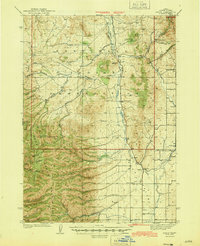
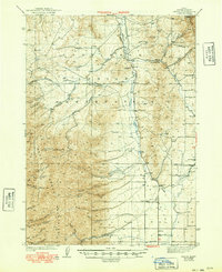
1944 Map of Arbon
USGS Topo · Published 1944About this map
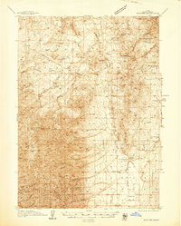
Fort Hall Indian Reservation occupies the northern half of this Idaho territory, where the drainage of Moonshine Creek and Bannock Creek shapes the high desert terrain. To the south, the Deep Creek Mountains dominate the western landscape, rising to peaks like Bannock Pk and White Quartz Mtn. The map reveals a remote ranching economy centered around small settlements like Arbon and Pauline, which are supported by local institutions such as Arbon Sch and Armstrong Sch. Early aviation infrastructure is also evident, with an Airway Beacon and a dedicated Landing Field positioned along the valley floor. Numerous family-named homesteads, including Rudeen Ranch and Jensen Ranch, are scattered throughout the draws and flats, marking the private holdings that existed alongside the vast public lands of the Cache N F.
Find a feature on this map
51 named features on this map. Tap any name to fly to it.
Don’t see what you’re looking for? This feature index may not catch every label — zoom into the map to look around manually.
Map Details
Editions of this 1944 Arbon Map
2 editions found
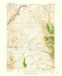
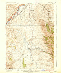
Other maps of this area

1934 · American Falls
USGS Topo · 1:62,500

1934 · Michaud
USGS Topo · 1:62,500
1934 · Rockland
USGS Topo · 1:62,500

1936 · American Falls
USGS Topo · 1:62,500
1937 · Rockland
USGS Topo · 1:62,500

1937 · Pocatello
USGS Topo · 1:48,000

1937 · Michaud
USGS Topo · 1:62,500
1938 · Pauline
USGS Topo · 1:48,000

1944 · Pocatello
USGS Topo · 1:62,500

1954 · Pocatello
USGS Topo · 1:250,000