
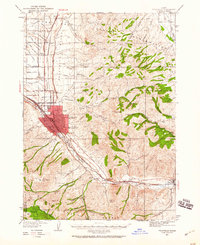
1937 Map of Pocatello
USGS Topo · Published 1937About this map
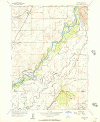
The Portneuf River valley serves as the primary corridor for development in the late 1930s, anchored by the growing urban centers of Pocatello and Alameda. The map illustrates a landscape transitioning from the industrial and educational hub around the University of Idaho Southern Branch to the agricultural reaches of the Fort Hall Indian Reservation and the timbered slopes of the Caribou National Forest. Infrastructure is a dominant theme, with the Union Pacific railroad and Highway Nos 91 and 30N following the river's path, while a network of irrigation features like the Main Canal and Panther Wasteway support the outlying settlements of Tyhee and Chubbuck. Researchers can find localized social details including the County Fairgrounds and rural educational landmarks like Portneuf Sch and Blackrock Sch that served the valley's disparate farming communities.
Find a feature on this map
40 named features on this map. Tap any name to fly to it.
Don’t see what you’re looking for? This feature index may not catch every label — zoom into the map to look around manually.
Map Details
Editions of this 1937 Pocatello Map
3 editions found
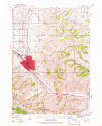
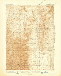
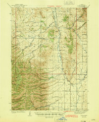
Other maps of this area

1934 · Michaud
USGS Topo · 1:62,500

1937 · Michaud
USGS Topo · 1:62,500
1938 · Pauline
USGS Topo · 1:48,000

1940 · Blackfoot
USGS Topo · 1:62,500

1943 · Blackfoot
USGS Topo · 1:62,500

1944 · Pocatello
USGS Topo · 1:62,500
1944 · Arbon
USGS Topo · 1:62,500

1954 · Pocatello
USGS Topo · 1:250,000

1955 · Yandell Springs
USGS Topo · 1:62,500
1955 · Pingree
USGS Topo · 1:24,000