Loading...
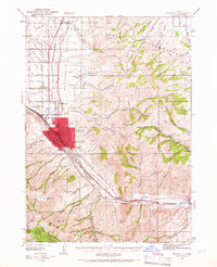
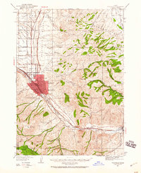
Loading map...1937 Map of Pocatello
USGS Topo · Published 1966About this map
The University of Idaho Southern Branch serves as a focal point for the growing city of Pocatello, which expanded significantly during the late 1930s. This survey illustrates the urban core's relationship with neighboring Alameda and the agricultural periphery including Chubbuck and Tyhee. The landscape is defined by the Portneuf River corridor, which dictated the path of the Union Pacific railroad and the Old Oregon Trail, marking the historic transit routes through this Idaho mountain gateway.
Find a feature on this map
68 named features on this map. Tap any name to fly to it.
Don’t see what you’re looking for? This feature index may not catch every label — zoom into the map to look around manually.
Map Details
Date Portrayed1937
Date Published1966
PublisherU.S. Geological Survey
Map TypeTopographic
Scale1:62,500
Physical Dimensions16.9 x 20.8 inches
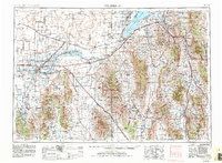
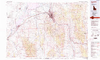
Editions of this 1937 Pocatello Map
3 editions found

Historical Maps of Pocatello Through Time
5 maps found


Featured Locations
Source Details
SourceU.S. Geological Survey
CopyrightPublic Domain