
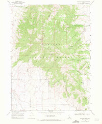
1968 Map of Dairy Creek
USGS Topo · Published 1971About this map
Little Malad Spring and the headwaters of Dairy Creek define the high-country hydrology of this Idaho landscape during the late 1960s. The terrain is characterized by a series of prominent drainage systems, including Harold Johns Canyon and Mine Canyon, which cut through the mountain slopes. The eastern boundary of the map follows the edge of the Caribou National Forest, where the land rises toward the divide between Oneida and Bannock counties.
Find a feature on this map
18 named features on this map. Tap any name to fly to it.
Don’t see what you’re looking for? This feature index may not catch every label — zoom into the map to look around manually.
Map Details
Editions of this 1968 Dairy Creek Map
This is the sole edition of this map. No revisions or reprints were ever made.
Other maps of this area

1938 · Pauline
USGS Topo · 1:48,000

1944 · Arbon
USGS Topo · 1:62,500

1954 · Pocatello
USGS Topo · 1:250,000

1958 · Pocatello
USGS Topo · 1:250,000

1963 · Daniels
USGS Topo · 1:24,000

1968 · Daniels
USGS Topo · 1:24,000

1968 · Wakley Peak
USGS Topo · 1:24,000
1968 · Elkhorn Peak
USGS Topo · 1:24,000

1968 · Hawkins
USGS Topo · 1:24,000

1968 · Bradley Mtn
USGS Topo · 1:24,000