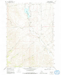
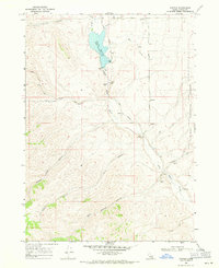
1963 Map of Daniels
USGS Topo · Published 1993About this map
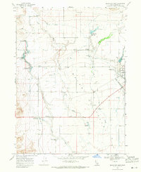
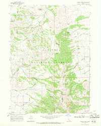
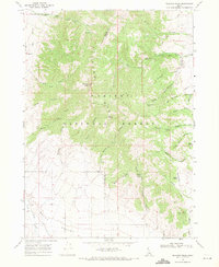
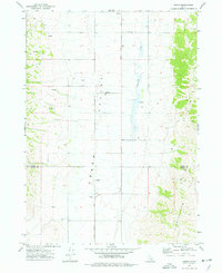
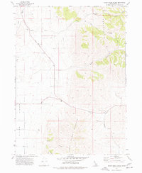
Daniels sits at the northern edge of this high-elevation Idaho landscape, where the Little Malad River is managed through a series of water control features. The Daniels Reservoir, held by Daniels Dam, serves as a central landmark for the surrounding terrain. Further south, the Elkhorn Dam and a nearby Gaging Station indicate the early infrastructure managing mountain runoff for the region's agricultural and ranching needs. To the west and south, the terrain becomes deeply etched by canyons such as Sublette Canyon and West Elkhorn Canyon, while the eastern boundary is defined by the Caribou National Forest. Local history is preserved in small details, such as a solitary Grave near Daniels Road and several gravel pits and a Quarry that reflect the localized extraction industry of the mid-1960s.
Find a feature on this map
29 named features on this map. Tap any name to fly to it.
Don’t see what you’re looking for? This feature index may not catch every label — zoom into the map to look around manually.
Map Details
Editions of this 1963 Daniels Map
This is the sole edition of this map. No revisions or reprints were ever made.
Other maps of this area

1954 · Pocatello
USGS Topo · 1:250,000

1958 · Pocatello
USGS Topo · 1:250,000
1968 · Ireland Springs
USGS Topo · 1:24,000
1968 · Daniels
USGS Topo · 1:24,000
1968 · Dairy Creek
USGS Topo · 1:24,000
1968 · Malad City West
USGS Topo · 1:24,000
1968 · Wakley Peak
USGS Topo · 1:24,000
1968 · Elkhorn Peak
USGS Topo · 1:24,000
1973 · Arbon
USGS Topo · 1:24,000
1973 · Sheep Creek Spring
USGS Topo · 1:24,000