1950s Maps of Bingham County, Idaho
Explore 21 historic maps of Bingham County from the 1950s. These maps offer a rare glimpse into what life looked like during the 1950s — showing old roads, neighborhoods, homes, and landmarks that have changed or disappeared over time.
Whether you're researching your family's past, planning a metal detecting trip, or studying how Bingham County's landscape evolved across the 1950s, these high-resolution maps are a powerful tool for exploring the history of this region.
- Focus on a specific era: All maps on this page are from the 1950s, giving you a focused view of this time period.
- See what’s changed: Compare century-old streets, trails, and buildings to today's modern landscape using overlays and satellite layers.
- Research with precision: Use these maps for genealogy, historical research, land use analysis, or educational projects.
- View, download, or print: Maps are fully viewable online in high resolution, and can be downloaded or printed for your own records.
Start exploring Bingham County's history through authentic maps from the 1950s. This is your window into the past.
Bingham County, ID maps
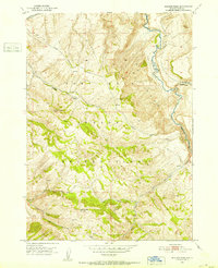
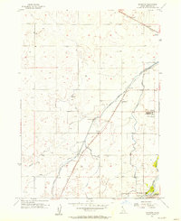
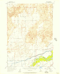
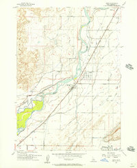
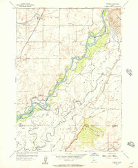
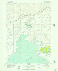
(21)- 1950 Map of Woodville
 1950 Woodville1950 Print · USGSCovers Bingham County, including Woodville, Shelley, and other nearby areas
 - 1950 Map of Idaho Falls South
 1950 Idaho Falls South1950 Print · USGSCovers Bingham County, including Idaho Falls, Taylorville, and other nearby areas
 - 1950 Map of Goshen, 1976 Print
 1950 Goshen1976 Print · USGSCovers Bingham County, including Goshen, Cox, and other nearby areas
 - 1951 Map of Higham Peak, 1952 Print
 1951 Higham Peak1952 Print · USGSCovers Bingham County, including Alridge, United States, and other nearby areas2 unique versions available
 - 1952 Map of Goshen
 1952 Goshen1952 Print · USGSCovers Bingham County, including Goshen, Cox, and other nearby areas
 - 1954 Map of Pocatello, 1963 Print
 1954 Pocatello1963 Print · USGSCovers Bingham County, including Pocatello, Burley, and other nearby areas4 unique versions available
 - 1955 Map of Springfield NW, 1956 Print
 1955 Springfield NW1956 Print · USGSCovers Bingham County, including United States, Idaho, and other nearby areas2 unique versions available
 - 1955 Map of Baldy Knoll, 1956 Print
 1955 Baldy Knoll1956 Print · USGSCovers Bingham County, including United States, Idaho, and other nearby areas2 unique versions available
 - 1955 Map of Lincoln Creek, 1957 Print
 1955 Lincoln Creek1957 Print · USGSCovers Bingham County, including United States, Idaho, and other nearby areas2 unique versions available
 - 1955 Map of Rockford, 1957 Print
 1955 Rockford1957 Print · USGSCovers Bingham County, including Liberty, Rockford, and other nearby areas2 unique versions available
 - 1955 Map of Rose, 1957 Print
 1955 Rose1957 Print · USGSCovers Bingham County, including McDonaldville, Rose, and other nearby areas2 unique versions available
 - 1955 Map of Firth, 1957 Print
 1955 Firth1957 Print · USGSCovers Bingham County, including Firth, Basalt, and other nearby areas2 unique versions available
 - 1955 Map of Yandell Springs, 1957 Print
 1955 Yandell Springs1957 Print · USGSCovers Bingham County, including Alridge, Bannock County, and other nearby areas
 - 1955 Map of Pingree, 1957 Print
 1955 Pingree1957 Print · USGSCovers Bingham County, including Fort Hall, Pingree, and other nearby areas4 unique versions available
 - 1955 Map of Springfield, 1957 Print
 1955 Springfield1957 Print · USGSCovers Bingham County, including Springfield, Sterling, and other nearby areas3 unique versions available
 - 1955 Map of Idaho Falls, 1963 Print
 1955 Idaho Falls1963 Print · USGSCovers Bingham County, including Idaho Falls, Blackfoot, and other nearby areas5 unique versions available
 - 1955 Map of Driggs, 1967 Print
 1955 Driggs1967 Print · USGSCovers Bingham County, including Idaho Falls, Rexburg, and other nearby areas3 unique versions available
 - 1958 Map of Driggs
 1958 Driggs1958 Print · USGSCovers Bingham County, including Idaho Falls, Rexburg, and other nearby areas2 unique versions available
 - 1958 Map of Idaho Falls
 1958 Idaho Falls1958 Print · USGSCovers Bingham County, including Idaho Falls, Blackfoot, and other nearby areas2 unique versions available
 - 1958 Map of Pocatello
 1958 Pocatello1958 Print · USGSCovers Bingham County, including Pocatello, Burley, and other nearby areas2 unique versions available
 - 1959 Map of Woodville, 1979 Print
 1959 Woodville1979 Print · USGSCovers Bingham County, including Woodville, Shelley, and other nearby areas
End of results
Showing maps 1-21 of 21
Top cities of Bingham County
- Blackfoot historical maps
- Aberdeen historical maps
- Firth historical maps
- Basalt historical maps
- Atomic City historical maps
Frequently asked questions
- What are the different types of historical maps available for Bingham County?
- What is the oldest map of Bingham County?
- Where can I purchase historical maps of Bingham County for my home or office?
- Where can I download high-res historical maps of Bingham County?
- Are there historical topographic maps available for Bingham County?
- Is there historical aerial imagery available for Bingham County?
- Where are historical maps of Bingham County sourced from?