1980s Maps of Bingham County, Idaho
Explore 16 historic maps of Bingham County from the 1980s. These maps offer a rare glimpse into what life looked like during the 1980s — showing old roads, neighborhoods, homes, and landmarks that have changed or disappeared over time.
Whether you're researching your family's past, planning a metal detecting trip, or studying how Bingham County's landscape evolved across the 1980s, these high-resolution maps are a powerful tool for exploring the history of this region.
- Focus on a specific era: All maps on this page are from the 1980s, giving you a focused view of this time period.
- See what’s changed: Compare century-old streets, trails, and buildings to today's modern landscape using overlays and satellite layers.
- Research with precision: Use these maps for genealogy, historical research, land use analysis, or educational projects.
- View, download, or print: Maps are fully viewable online in high resolution, and can be downloaded or printed for your own records.
Start exploring Bingham County's history through authentic maps from the 1980s. This is your window into the past.
Bingham County, ID maps
(16)- 1980 Map of Circular Butte
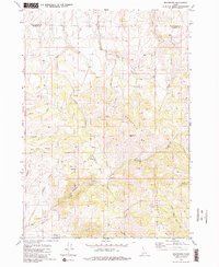
 1980 Circular Butte1980 Print · USGSEastern Idaho at the start of the eighties shows a landscape of federal research and agricultural expansion. Trace the growth of nuclear history at the Idaho National Engineering Laboratory and early settlements like Monteview, Terreton, and Sage Junction.
 - 1981 Map of Miner Creek
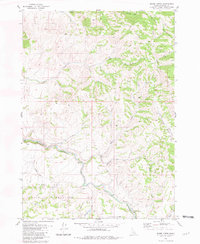 1981 Miner Creek1981 Print · USGSBingham County, Idaho, is shown in the early 1980s as a landscape of high ridges and vital water sources. Researchers can trace the boundary of the Fort Hall Indian Reservation or locate the historic Presto Trail as it crosses the Blackfoot River.
 - 1981 Map of Dunn Basin
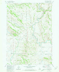 1981 Dunn Basin1981 Print · USGSBingham and Caribou counties are captured here in the early eighties, showcasing a rugged landscape defined by the Fort Hall Indian Reservation boundary. Researchers can trace remote routes like the Portneuf Presto Trail and find landmarks such as Morgan Bridge over the Blackfoot River.
 - 1981 Map of Meadow Creek Mtn
 1981 Meadow Creek Mtn1981 Print · USGSBingham and Caribou Counties are captured in the early eighties as the waters of the Blackfoot Reservoir meet high mountain ridges. Researchers can trace livestock history and backcountry landmarks at Association Corral, Meteor Hole, and Moses Pass.
 - 1981 Map of Paradise Valley
 1981 Paradise Valley1981 Print · USGSThe Blackfoot Mountains and Paradise Valley are shown in the early 1980s, revealing a landscape defined by its river and numerous springs. Researchers can trace land-use patterns through labeled fence lines and find historical recreation sites like Grave Creek Campground or Sagehen Campground.
 - 1981 Map of Castle Rock
 1981 Castle Rock1981 Print · USGSBonneville and Bingham counties met in this high Idaho forest land during the early eighties, a landscape of seasonal cattle camps and high-ridge trails. Researchers can locate the Fall Creek Cow Camp and trace the winding paths of Skyline Road and the Boundary Trail through the Caribou National Forest.
 - 1981 Map of Lincoln Peak
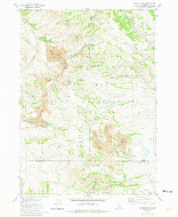 1981 Lincoln Peak1981 Print · USGSBingham County's mining and reservation lands are captured in the early eighties, showcasing the complex intersection of industry and tribal territory. Researchers can trace the massive Gay Mine complex, the Union Pacific rail spur, and remote water sources like Queedup Spring.
 - 1981 Map of Homer Valley
 1981 Homer Valley1981 Print · USGSSoutheast Idaho high country is captured here in the early eighties, revealing a landscape of high ridges and drainage basins. Genealogists and historians can trace old ranching infrastructure like corrals, storage bins, and the Cinder Pit near Homer Creek.
 - 1981 Map of Yandell Springs
 1981 Yandell Springs1981 Print · USGSThe high basins and reservation lands of southeastern Idaho are captured here during the early eighties. Researchers can trace historic water rights and transport routes through features like Yandell Springs, the Union Pacific tracks, and Wenee Ditch.
 - 1981 Map of Little Valley Hills
 1981 Little Valley Hills1981 Print · USGSSoutheast Idaho’s high country is captured in the early eighties as a complex network of county boundaries and mountain drainages. Genealogists and historians can trace the remote settlement of Homer or locate landmarks like the Cinder Pit and Little Valley Reservoir.
 - 1981 Map of Wolverine
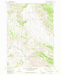
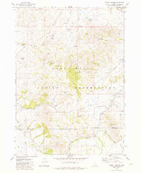
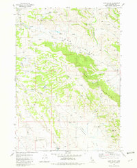
 1981 Wolverine1981 Print · USGSBingham County in the early 1980s is shown here as a high-country landscape of seasonal creeks and mountain basins. Researchers can trace the drainages of Wolverine Creek through The Narrows, find the settlement at Wolverine, and locate several remote springs.2 unique versions available
 - 1981 Map of Poison Creek
 1981 Poison Creek1981 Print · USGSThe Blackfoot Mountains in the early 1980s reveal a high-country landscape of remote ridges and deep basins. Researchers can trace the drainage of Willow Creek or locate landmarks like Tanner Pass and the isolated Grave near Mill Creek.
 - 1981 Map of Jumpoff Hill, 1982 Print
 1981 Jumpoff Hill1982 Print · USGSSoutheast Idaho's high country is documented here in the early 1980s, showcasing the rugged divide between Bonneville and Bingham counties. Researchers can trace historic water sources and land use through landmarks like Empey Spring, Grays Lake Outlet, and Pine Mountain.
 - 1981 Map of Long Valley, 1982 Print
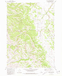
 1981 Long Valley1982 Print · USGSBingham County was a landscape of high-country grazing and seasonal water management in the early eighties. Genealogists and local historians can trace legacy water rights and stock routes through landmarks like Robison Reservoir, Mollies Nipple, and Dynamite Spring.
 - 1984 Map of Pocatello
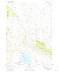
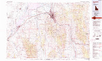 1984 Pocatello1984 Print · USGSSoutheast Idaho in the early eighties centers on the industrial and rail corridor between Pocatello and the Snake River. Genealogists and historians can trace routes through the Fort Hall Indian Reservation or locate family sites near American Falls and Lava Hot Springs.2 unique versions available
 - 1986 Map of Palisades, 1987 Print
 1986 Palisades1987 Print · USGSThe Idaho-Wyoming borderlands are captured here in the mid-1980s, where the high ridges of the Caribou Range meet the vital Snake River corridor. Researchers can trace the water-management history of Palisades Reservoir or locate the Monte Cristo Mine and Evergreen Mine near the Caribou Basin.2 unique versions available
End of results
Showing maps 1-16 of 16
Top cities of Bingham County
- Blackfoot historical maps
- Aberdeen historical maps
- Firth historical maps
- Basalt historical maps
- Atomic City historical maps
Frequently asked questions
- What are the different types of historical maps available for Bingham County?
- What is the oldest map of Bingham County?
- Where can I purchase historical maps of Bingham County for my home or office?
- Where can I download high-res historical maps of Bingham County?
- Are there historical topographic maps available for Bingham County?
- Is there historical aerial imagery available for Bingham County?
- Where are historical maps of Bingham County sourced from?