1970s Maps of Bingham County, Idaho
Explore 36 historic maps of Bingham County from the 1970s. These maps offer a rare glimpse into what life looked like during the 1970s — showing old roads, neighborhoods, homes, and landmarks that have changed or disappeared over time.
Whether you're researching your family's past, planning a metal detecting trip, or studying how Bingham County's landscape evolved across the 1970s, these high-resolution maps are a powerful tool for exploring the history of this region.
- Focus on a specific era: All maps on this page are from the 1970s, giving you a focused view of this time period.
- See what’s changed: Compare century-old streets, trails, and buildings to today's modern landscape using overlays and satellite layers.
- Research with precision: Use these maps for genealogy, historical research, land use analysis, or educational projects.
- View, download, or print: Maps are fully viewable online in high resolution, and can be downloaded or printed for your own records.
Start exploring Bingham County's history through authentic maps from the 1970s. This is your window into the past.
Bingham County, ID maps
(36)- 1971 Map of Fort Hall, 1974 Print
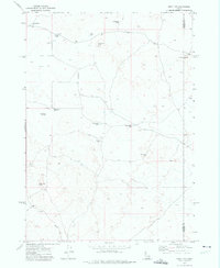
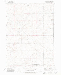
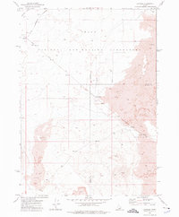
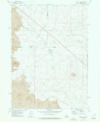
 1971 Fort Hall1974 Print · USGSThe Fort Hall Indian Reservation in the early seventies shows a complex landscape of irrigation and rail. Genealogists and historians can trace local landmarks like Fort Hall Indian Agency, Good Shepherd Cem, and the prominent Ferry Butte.
 - 1971 Map of Buckskin Basin, 1974 Print
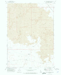
 1971 Buckskin Basin1974 Print · USGSThe Fort Hall Indian Reservation in the early seventies shows a landscape shaped by irrigation and rail. Researchers can trace the Fort Hall Main Canal and locate the Ross Fork Indian School and Ross Fork Cem.
 - 1971 Map of Schiller, 1974 Print
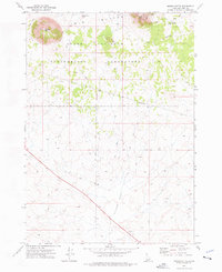
 1971 Schiller1974 Print · USGSPower County, Idaho, is captured here in the early 1970s as the regional economy revolved around the Snake River shoreline and the Michaud Flats. Genealogists and historians can trace the Union Pacific rail line, the rural settlement of Schiller, and the Indian Cem within the Fort Hall Indian Reservation.
 - 1971 Map of American Falls SW, 1974 Print
 1971 American Falls SW1974 Print · USGSPower County, Idaho, is captured in the early 1970s as a hub of river-fed industry and ranching along the American Falls Reservoir. Genealogists and researchers can trace the Union Pacific line and family landmarks like Western Home Ranch and Rueger Springs.
 - 1971 Map of Aberdeen, 1974 Print
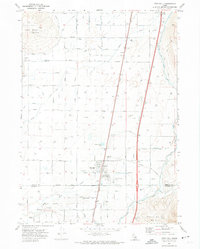
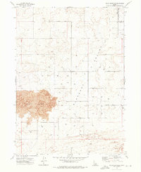
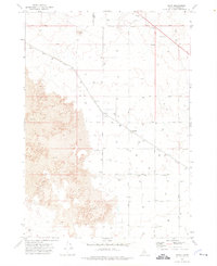
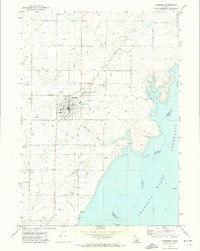 1971 Aberdeen1974 Print · USGSBingham County agriculture and the Snake River irrigation network are in full view in the early seventies. Genealogists and historians can locate the Cem, the High Sch, and the local Aberdeen Airport amidst the Union Pacific rail lines.
 - 1971 Map of American Falls NW, 1974 Print
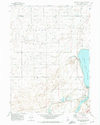
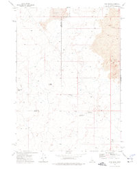
 1971 American Falls NW1974 Print · USGSBingham County agriculture and infrastructure are captured in the early 1970s before major modern shifts in local land use. Genealogists and historians can trace family locations near the Homestead Cem, Aberdeen Airport, and along the High Line Canal.
 - 1971 Map of American Falls, 1974 Print
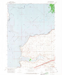
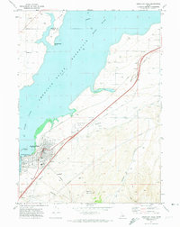 1971 American Falls1974 Print · USGSAmerican Falls is captured here in the early 1970s at the intersection of the Snake River and the Union Pacific rail line. Researchers can trace the town's civic layout, find Falls View Cem, and study the massive American Falls Dam and its reservoir.
 - 1971 Map of Blackfoot, 1974 Print
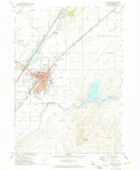 1971 Blackfoot1974 Print · USGSBingham County's river-fed agriculture is on full display in the early 1970s, centered on the growing hub of Blackfoot. Genealogists and researchers can trace local landmarks like Grove City Cem, Jensen Grove Church, and the Union Pacific rail corridor.
 - 1971 Map of Moreland, 1974 Print
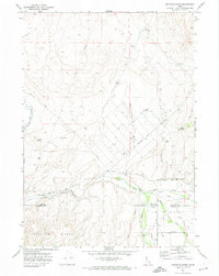
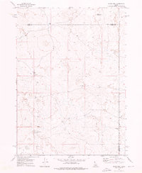
 1971 Moreland1974 Print · USGSBingham County farming life in the early seventies is mapped here through its intricate canal networks and rail-side settlements. Researchers can trace family history through sites like the Thomas Riverside Cemetery, Snake River High Sch, and the Union Pacific depot at Aberdeen Junction.
 - 1972 Map of Split Top, 1975 Print
 1972 Split Top1975 Print · USGSBlaine and Bingham counties are captured in the early 1970s, showcasing a remote landscape of high-desert water management and ranching. Trace early landmarks such as Packsaddle Butte, the Ruins near the county line, and scattered cisterns.
 - 1972 Map of Pillar Butte SE, 1976 Print
 1972 Pillar Butte SE1976 Print · USGSPower and Bingham counties in the early seventies reveal a high-desert landscape shaped by volcanic geology and agricultural engineering. Researchers can trace the edge of the Wapi Flow and locate dozens of remote wells and a small Cem in Pleasant Valley.
 - 1972 Map of Mosby Well, 1976 Print
 1972 Mosby Well1976 Print · USGSThe Snake River Plain high desert is captured here in the early 1970s, showing a landscape defined by its remote water sources. Researchers can trace the isolated network of a Jeep Trail leading to essential outposts like Mosby Well and Gasten Beattie Well.
 - 1972 Map of Sunset Lake, 1976 Print
 1972 Sunset Lake1976 Print · USGSThe Idaho backcountry at the start of the 1970s reveals a vast, undeveloped landscape where Butte, Blaine, and Bingham counties converge. Researchers can trace the minimal paths of a Jeep Trail reaching out toward Sunset Lake and Rock Corral Butte.
 - 1972 Map of Pillar Butte NE, 1977 Print
 1972 Pillar Butte NE1977 Print · USGSPower and Bingham counties meet in this high-desert landscape during the early 1970s. Researchers can trace the rugged network of Jeep Trails across Pleasant Valley and identify landmarks like Flat Top.
 - 1973 Map of Little Butte NE, 1976 Print
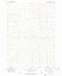 1973 Little Butte NE1976 Print · USGSIn the early 1970s, the high desert of the Snake River Plain served as a vital center for nuclear research and industrial testing. Researchers can trace the boundaries of the Idaho National Engineering Laboratory and the convergence of three counties near Tractor Flat.
 - 1973 Map of Olsen, 1976 Print
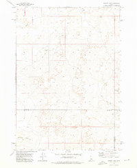
 1973 Olsen1976 Print · USGSBingham County agricultural life in the early seventies centers on the rail-side settlements of Olsen and Havens. Researchers can trace the Union Pacific line and locate numerous family-farm infrastructure like storage bins and wells.
 - 1973 Map of Little Butte NW, 1976 Print
 1973 Little Butte NW1976 Print · USGSThe Snake River Plain in the early seventies reveals the technical landscape of the Idaho National Engineering Laboratory. Researchers can trace the path of Lincoln Boulevard and locate specific sites like a Borrow Pit and a remote Well.
 - 1973 Map of Scoville, 1976 Print
 1973 Scoville1976 Print · USGSThe high-desert research landscape of Butte County is shown here in the early seventies, dominated by federal infrastructure. Map collectors and researchers can trace the Government Railroad serving Scoville and the Idaho National Engineering Laboratory.
 - 1973 Map of Middle Butte, 1976 Print
 1973 Middle Butte1976 Print · USGSBingham County's volcanic desert landscape is captured in the early 1970s, showcasing the high-security grounds of the Idaho National Engineering Laboratory. Researchers can locate geological landmarks like Middle Butte Cave and Moonshiners Cave among the Twin Buttes.
 - 1973 Map of Taber, 1976 Print
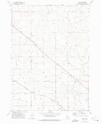
 1973 Taber1976 Print · USGSBingham County settlement and rail transport are defined by the volcanic landscape during the 1970s. Trace the diagonal path of the Union Pacific through Taber and Fullmer, and locate rural infrastructure like the Landing Strip and Storage Bins.
 - 1973 Map of Rock Butte, 1976 Print
 1973 Rock Butte1976 Print · USGSSoutheast Idaho in the early seventies is recorded here as a landscape of basalt and survival along the Butte County line. Researchers can trace the remote network of a Jeep Trail connecting isolated water sites like Moose Res and Rock Butte.
 - 1973 Map of Atomic City, 1976 Print
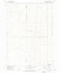
 1973 Atomic City1976 Print · USGSThe high desert plains of Bingham County were undergoing unique development in the early 1970s at the height of the atomic age. Researchers can trace the infrastructure of the Idaho National Engineering Laboratory and the small settlement of Atomic City near landmarks like Table Legs Butte.
 - 1973 Map of Coffee Point SW, 1976 Print
 1973 Coffee Point SW1976 Print · USGSBingham County, Idaho, appears as a surveyed desert landscape during the early 1970s. For the researcher of the Snake River Plain, this map documents the exact locations of vital infrastructure like the numerous wells that sustained this arid terrain.
 - 1973 Map of Lava Lake Reservoir, 1976 Print
 1973 Lava Lake Reservoir1976 Print · USGSBingham County in the 1970s reveals a volcanic landscape shaped by the Lava flows and managed water resources. Trace the path of the Union Pacific railroad or locate remote features like Lava Lake Reservoir and the WT No 2 Well.
 - 1973 Map of Coffee Point NE, 1976 Print
 1973 Coffee Point NE1976 Print · USGSBingham County is shown as a functional ranching landscape in the early 1970s, defined by its critical water infrastructure. Researchers can trace the network of vital watering holes and tracks, including Sheep Lake Reservoir, Camp Reservoir, and the rugged Jeep Trail.
Showing maps 1-25 of 36
Top cities of Bingham County
- Blackfoot historical maps
- Aberdeen historical maps
- Firth historical maps
- Basalt historical maps
- Atomic City historical maps
Frequently asked questions
- What are the different types of historical maps available for Bingham County?
- What is the oldest map of Bingham County?
- Where can I purchase historical maps of Bingham County for my home or office?
- Where can I download high-res historical maps of Bingham County?
- Are there historical topographic maps available for Bingham County?
- Is there historical aerial imagery available for Bingham County?
- Where are historical maps of Bingham County sourced from?