1950s Maps of Bingham County, Idaho
Explore 21 historic maps of Bingham County from the 1950s. These maps offer a rare glimpse into what life looked like during the 1950s — showing old roads, neighborhoods, homes, and landmarks that have changed or disappeared over time.
Whether you're researching your family's past, planning a metal detecting trip, or studying how Bingham County's landscape evolved across the 1950s, these high-resolution maps are a powerful tool for exploring the history of this region.
- Focus on a specific era: All maps on this page are from the 1950s, giving you a focused view of this time period.
- See what’s changed: Compare century-old streets, trails, and buildings to today's modern landscape using overlays and satellite layers.
- Research with precision: Use these maps for genealogy, historical research, land use analysis, or educational projects.
- View, download, or print: Maps are fully viewable online in high resolution, and can be downloaded or printed for your own records.
Start exploring Bingham County's history through authentic maps from the 1950s. This is your window into the past.
Bingham County, ID maps
(21)- 1950 Map of Woodville
 1950 Woodville1950 Print · USGSSoutheast Idaho at mid-century reveals a landscape divided between the ancient Lava flows and a burgeoning agricultural network. Researchers can trace the development of irrigation systems like the Great Western Canal and locate the Woodville Cem near the banks of the Snake River.
 - 1950 Map of Idaho Falls South
 1950 Idaho Falls South1950 Print · USGSThe Snake River Plain south of Idaho Falls reveals an intricate mid-century network of irrigation canals and rural school districts. Genealogists can locate family landmarks like New Sweden Cemetery, the LDS Temple, and the Riverdale Sch (Aband'd).
 - 1950 Map of Goshen, 1976 Print
 1950 Goshen1976 Print · USGSIn the early 1950s, the Bingham County countryside was a complex network of rail and irrigation. Genealogists and local historians can trace family roots through the Goshen community, rural landmarks like the Jameston Sch, and the Union Pacific corridor.
 - 1951 Map of Higham Peak, 1952 Print
 1951 Higham Peak1952 Print · USGSThe Fort Hall Indian Reservation in the early fifties reveals a landscape of high peaks and vital waterways. Genealogists and historians can trace the Portneuf Presto Trail and locate family landmarks near Higham Peak or the Blackfoot River.2 unique versions available
 - 1952 Map of Goshen
 1952 Goshen1952 Print · USGSBingham County agriculture and irrigation are captured here in the early 1950s as water management reshaped the Snake River Plain. Trace the vital network of the Highline Canal and Idaho Canal alongside landmarks like Jameston Sch and the Snake River.
 - 1954 Map of Pocatello, 1963 Print
 1954 Pocatello1963 Print · USGSSoutheast Idaho in the mid-1950s reveals a landscape shaped by massive water reclamation and mountain forests. Researchers can trace the development of the Fort Hall Indian Reservation or locate specific landmarks like the Arbon P O and Emerson School.4 unique versions available
 - 1955 Map of Springfield NW, 1956 Print
 1955 Springfield NW1956 Print · USGSBingham County in the mid-1950s is shown as a rugged expanse of volcanic terrain and sparse ranching infrastructure. Researchers can trace early water management and transport routes through features like Number 1 Well, the Springfield Taber Road, and a Windmill.2 unique versions available
 - 1955 Map of Baldy Knoll, 1956 Print
 1955 Baldy Knoll1956 Print · USGSBingham County agriculture meets volcanic basalt flows in the mid-1950s. Genealogists and historians can trace irrigation development and local landmarks like Moreland, the Aberdeen Canal, and Lemhi Pass.2 unique versions available
 - 1955 Map of Lincoln Creek, 1957 Print
 1955 Lincoln Creek1957 Print · USGSThe Fort Hall Indian Reservation in the mid-1950s shows a landscape transformed by irrigation ditches and historic frontier sites. Researchers can locate the Fort Hall No. 2 Historic Site and trace water routes like the Presto Ditch and Lincoln Creek.2 unique versions available
 - 1955 Map of Rockford, 1957 Print
 1955 Rockford1957 Print · USGSBingham County agriculture and rail infrastructure are in focus during the mid-fifties, centered on the community of Rockford. Genealogists and historians can trace the irrigation network from Rockford Canal to Thomas and find local landmarks like the Snake River Jr High Sch.2 unique versions available
 - 1955 Map of Rose, 1957 Print
 1955 Rose1957 Print · USGSBingham County agriculture and irrigation are in full focus during the mid-fifties as the Snake River feeds an intricate canal network. Genealogists and local historians can trace the foundations of Rose and locate local landmarks like the Lavaside Sch and the Weggland school.2 unique versions available
 - 1955 Map of Firth, 1957 Print
 1955 Firth1957 Print · USGSBingham County agricultural life in the mid-fifties centered on the rail-and-river corridor between Shelley and Firth. Local historians can trace the intricate network of the Great Western Canal, the Hillcrest Cemetery, and the Basalt rail siding.2 unique versions available
 - 1955 Map of Yandell Springs, 1957 Print
 1955 Yandell Springs1957 Print · USGSBingham County in the mid-1950s was a landscape of high-country springs and developing phosphate mines. Researchers can trace the Fort Hall Indian Reservation boundary, locate the Westvaco Mine, and find the Fort Hall No 2 Historic Site.
 - 1955 Map of Pingree, 1957 Print
 1955 Pingree1957 Print · USGSThe Snake River plain in the mid-fifties shows a landscape of deep historical layers, where the Route of Old Oregon Trail crosses the Fort Hall Indian Reservation. Trace early transit and water rights through the Union Pacific tracks, local cemeteries, and the Aberdeen Springfield Canal.4 unique versions available
 - 1955 Map of Springfield, 1957 Print
 1955 Springfield1957 Print · USGSBingham County agriculture and river life meet in the mid-1950s near the northern reaches of the American Falls Reservoir. Researchers can trace the path of the Oregon Trail past the Fort Hall Historic Monument or locate family roots in Springfield and Sterling.3 unique versions available
 - 1955 Map of Idaho Falls, 1963 Print
 1955 Idaho Falls1963 Print · USGSThe Snake River Plain and its surrounding volcanic peaks are captured in the late fifties, showing the region's unique mix of nuclear research and high-desert ranching. Trace the industrial footprint of the National Reactor Testing Station or find old mining sites like Empire Mine.5 unique versions available
 - 1955 Map of Driggs, 1967 Print
 1955 Driggs1967 Print · USGSEastern Idaho and Western Wyoming appear at a mid-century crossroads as the river valleys were fully settled and the high peaks protected. Genealogists and researchers can trace the rail towns of Rexburg and Driggs or follow the Snake River from Irwin to the Palisades Reservoir.3 unique versions available
 - 1958 Map of Driggs
 1958 Driggs1958 Print · USGSThe high Teton peaks and Snake River valleys are captured here in the mid-fifties, showing the region's agricultural and wilderness boundaries. Researchers can trace the Union Pacific rail corridor through Rexburg or locate early settlements like Clementsville and Tetonia.2 unique versions available
 - 1958 Map of Idaho Falls
 1958 Idaho Falls1958 Print · USGSEastern Idaho in the late fifties showcases the rapid expansion of agricultural and scientific outposts across its volcanic plains. Researchers can locate remote sites like Atomic City, mineral interests at White Knob Mine, and the cultural grounds of St Marys Mission.2 unique versions available
 - 1958 Map of Pocatello
 1958 Pocatello1958 Print · USGSSoutheastern Idaho in the late fifties was a landscape of expanding reservoirs and historic trails. Genealogists and historians can trace the Old Oregon Trail, locate the Bannock Creek Indian Day School, and study the many Union Pacific rail sidings.2 unique versions available
 - 1959 Map of Woodville, 1979 Print
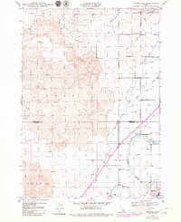 1959 Woodville1979 Print · USGSThe Snake River Plain in the mid-twentieth century reveals an intricate landscape of irrigation and volcanic terrain. Researchers can trace the development of Woodville and Shelley alongside extensive water networks like the Great Western Canal and Sidehill Canal.
End of results
Showing maps 1-21 of 21
Top cities of Bingham County
- Blackfoot historical maps
- Aberdeen historical maps
- Firth historical maps
- Basalt historical maps
- Atomic City historical maps
Frequently asked questions
- What are the different types of historical maps available for Bingham County?
- What is the oldest map of Bingham County?
- Where can I purchase historical maps of Bingham County for my home or office?
- Where can I download high-res historical maps of Bingham County?
- Are there historical topographic maps available for Bingham County?
- Is there historical aerial imagery available for Bingham County?
- Where are historical maps of Bingham County sourced from?