2020s Maps of Ketchum, Idaho
Explore 4 historic maps of Ketchum from the 2020s. These maps offer a rare glimpse into what life looked like during the 2020s — showing old roads, neighborhoods, homes, and landmarks that have changed or disappeared over time.
Whether you're researching your family's past, planning a metal detecting trip, or studying how Ketchum's landscape evolved across the 2020s, these high-resolution maps are a powerful tool for exploring the history of this region.
- Focus on a specific era: All maps on this page are from the 2020s, giving you a focused view of this time period.
- See what’s changed: Compare century-old streets, trails, and buildings to today's modern landscape using overlays and satellite layers.
- Research with precision: Use these maps for genealogy, historical research, land use analysis, or educational projects.
- View, download, or print: Maps are fully viewable online in high resolution, and can be downloaded or printed for your own records.
Start exploring Ketchum's history through authentic maps from the 2020s. This is your window into the past.
Ketchum, ID maps
(4)- 2020 Map of Sun Valley, 2020 Print
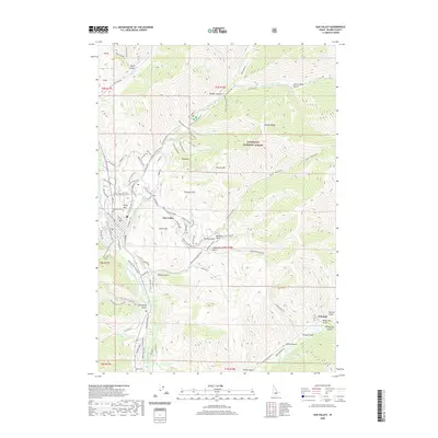 2020 Sun Valley2020 Print · USGSCovers Ketchum, including Sun Valley, Blaine County, and other nearby areas
 - 2020 Map of Griffin Butte, 2020 Print
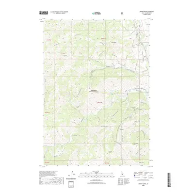 2020 Griffin Butte2020 Print · USGSCovers Ketchum, including Blaine County, United States, and other nearby areas
 - 2024 Map of Griffin Butte, 2024 Print
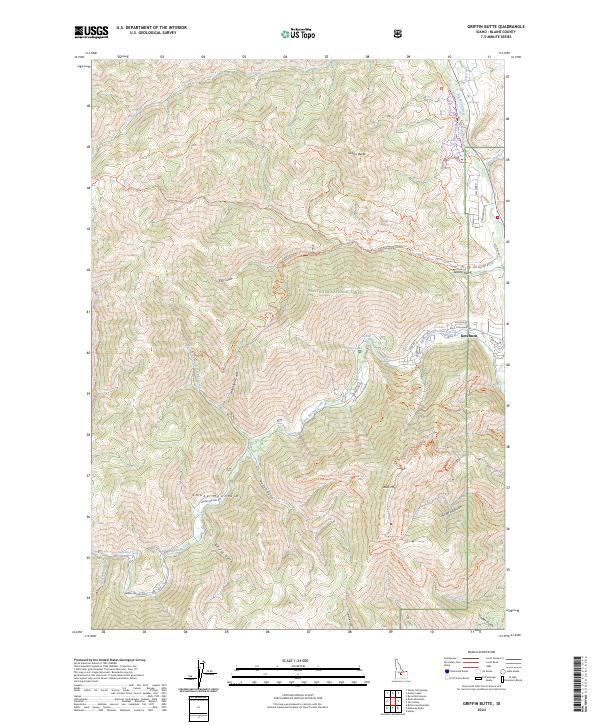 2024 Griffin Butte2024 Print · USGSKetchum and the surrounding peaks of the Sawtooth National Forest are shown in detail during this era of mountain recreation. Researchers can trace the complex network of trails and water sources, from the thermal Warfield Hot Spring to the summit of Bald Mtn.
 - 2024 Map of Sun Valley, 2024 Print
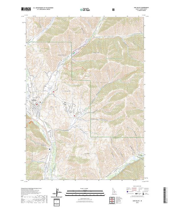 2024 Sun Valley2024 Print · USGSThe central Idaho highlands around Ketchum are documented here in 2024, showing the intersection of three mountain ranges and the Sun Valley resort area. Trace the winding paths of the Boundary Loop Ski Trail and the settlement at Triumph.
End of results
Showing maps 1-4 of 4
Top cities near Ketchum
Frequently asked questions
- What are the different types of historical maps available for Ketchum?
- What is the oldest map of Ketchum?
- Where can I purchase historical maps of Ketchum for my home or office?
- Where can I download high-res historical maps of Ketchum?
- Are there historical topographic maps available for Ketchum?
- Is there historical aerial imagery available for Ketchum?
- Where are historical maps of Ketchum sourced from?