Old Maps of Magic Resort, Idaho for Hiking & Exploration
Hike through history with 10 historic maps of Magic Resort. Explore old trails, ghost towns, and forgotten backroads — perfect for outdoor adventurers and local explorers.
- Rediscover forgotten places: Map out old mining camps, roads, and footpaths that no longer exist on modern maps.
- Layer with modern tools: Combine with LiDAR or satellite views to plan hikes through historical terrain.
- Made for exploration: Popular among hikers, overlanders, and local history lovers.
Use these maps to find adventure and explore the hidden past of Magic Resort.
Magic Resort, ID maps
(10)- 1955 Map of Hailey, 1968 Print
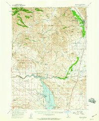
 1955 Hailey1968 Print · USGSCentral Idaho in the mid-fifties reveals a landscape transitioning from deep-rooted silver mining to a burgeoning outdoor economy. Researchers can trace the legacy of the Union Pacific line, the remote Triumph Mine, and original airfield layouts at Mountain Home Air Force Base.4 unique versions available
 - 1957 Map of Bellevue, 1959 Print
 1957 Bellevue1959 Print · USGSThe Wood River Valley and Bennett Hills are captured here in the late fifties, showing a landscape defined by mining, ranching, and the Union Pacific rail line. Genealogists can trace family-named sites like Stewart Ranch, find the Timmerman Cem, or locate the historic Apache Mill.2 unique versions available
 - 1959 Map of Hailey
 1959 Hailey1959 Print · USGSThe Sawtooth range and high desert plains of Southern Idaho are captured here during a period of mining and military growth. Genealogists and historians can locate mining sites like Triumph Mine, early settlements such as Idaho City, and the Mountain Home Air Force Base.2 unique versions available
 - 1962 Map of Hailey
 1962 Hailey1962 Print · USGSCentral Idaho in the early sixties showcases a landscape of high-altitude ranching and mining at the foot of the Sawtooth Mountains. Genealogists and historians can trace the rail-and-river economy through the Union Pacific Railroad corridor and explore old mining sites like the Triumph Mine or Silver Star Queens Mine.
 - 1986 Map of Magic Reservoir West
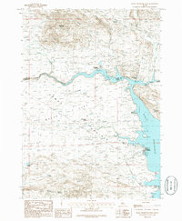 1986 Magic Reservoir West1986 Print · USGSCamas County and Blaine County meet at the edge of the Magic Reservoir in the mid-1980s. Local researchers can trace the footprint of leisure and industry through Moonstone Landing, the Abandoned Railroad, and the remote Magic Resort.
 - 2010 Map of Magic Reservoir West, 2010 Print
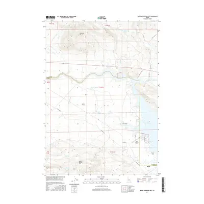
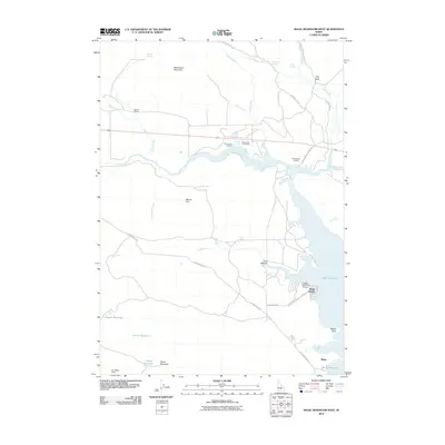 2010 Magic Reservoir West2010 Print · USGSCovers Magic Resort, including Blaine County, Camas County, and other nearby areas
 - 2013 Map of Magic Reservoir West, 2013 Print
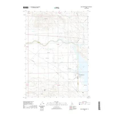
 2013 Magic Reservoir West2013 Print · USGSCovers Magic Resort, including Blaine County, Camas County, and other nearby areas
 - 2017 Map of Magic Reservoir West, 2017 Print
 2017 Magic Reservoir West2017 Print · USGSCovers Magic Resort, including Blaine County, Camas County, and other nearby areas
 - 2020 Map of Magic Reservoir West, 2020 Print
 2020 Magic Reservoir West2020 Print · USGSCovers Magic Resort, including Blaine County, Camas County, and other nearby areas
 - 2024 Map of Magic Reservoir West, 2024 Print
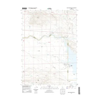
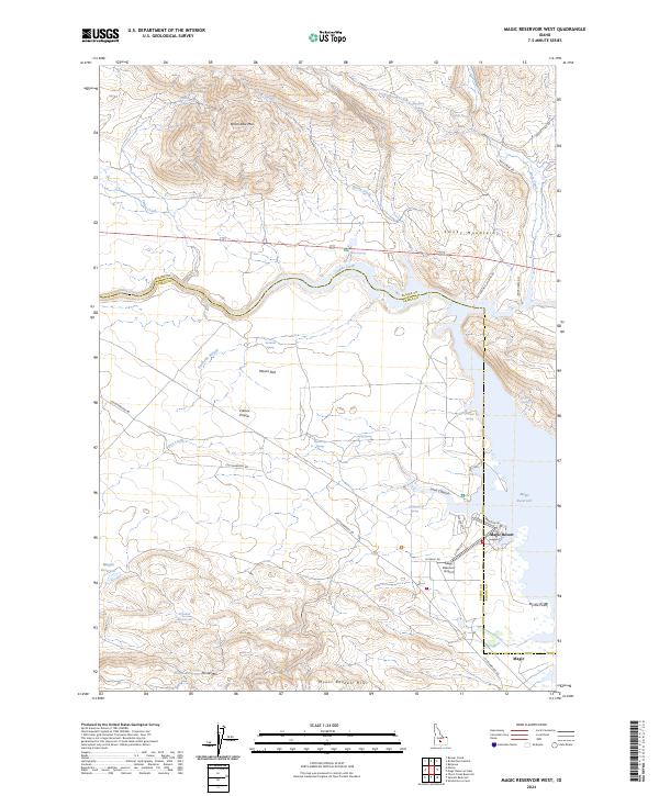 2024 Magic Reservoir West2024 Print · USGSCamas County and Blaine County meet at the edge of the reservoir in this recent study of Idaho’s high prairie. Researchers can trace the layout of the Magic Resort community, locate the Magic Reservoir Airport, and explore the rugged drainage of Lava Canyon.
End of results
Showing maps 1-10 of 10
Top cities near Magic Resort
Frequently asked questions
- What are the different types of historical maps available for Magic Resort?
- What is the oldest map of Magic Resort?
- Where can I purchase historical maps of Magic Resort for my home or office?
- Where can I download high-res historical maps of Magic Resort?
- Are there historical topographic maps available for Magic Resort?
- Is there historical aerial imagery available for Magic Resort?
- Where are historical maps of Magic Resort sourced from?