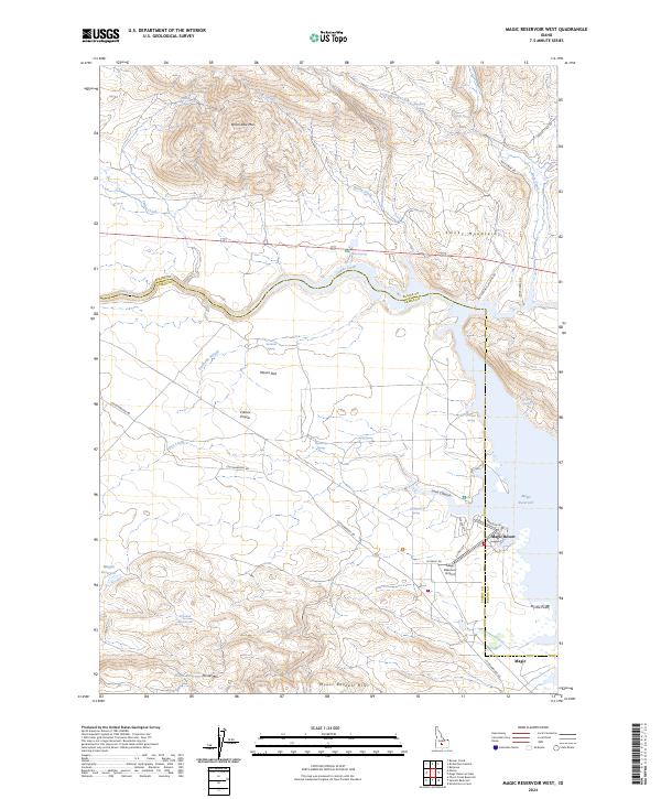
2024 Map of Magic Reservoir West
USGS Topo · Published 2024About this map
Camas Prairie defines the central landscape of this Idaho quadrangle, where the Camas Creek valley broadens into the flatlands of Macon Flat. The geography is bounded by significant relief, with the Smoky Mountains and Moonstone Mtn rising to the north and the Mount Bennett Hills to the south. Water management is a primary theme of the region, anchored by the western reaches of the Magic Reservoir and several smaller stock or irrigation pools including Magpie Reservoir, Grouse Reservoir, and Floyds Reservoir. Along the reservoir's western shore, the small community of Magic Resort and the nearby Magic settlement serve as local hubs, supported by the Magic Reservoir Airport. The area’s hydrological complexity is evident in the network of springs and canyons, such as Lava Canyon and Barrel Spring, which feed into the Northside Slough.
Find a feature on this map
49 named features on this map. Tap any name to fly to it.
Don’t see what you’re looking for? This feature index may not catch every label — zoom into the map to look around manually.
Map Details
Editions of this 2024 Magic Reservoir West Map
This is the sole edition of this map. No revisions or reprints were ever made.
Other maps of this area

1955 · Hailey
USGS Topo · 1:250,000

1957 · Thorn Creek
USGS Topo · 1:62,500

1957 · Bellevue
USGS Topo · 1:62,500

1957 · Blaine
USGS Topo · 1:62,500

1957 · Bellevue
USGS Topo · 1:24,000

1959 · Hailey
USGS Topo · 1:250,000

1962 · Hailey
USGS Topo · 1:250,000

1979 · Shoshone Ice Cave
USGS Topo · 1:24,000

1979 · Summit Reservoir
USGS Topo · 1:24,000
1986 · Bellevue
USGS Topo · 1:24,000