
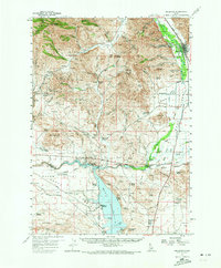
1957 Map of Bellevue
USGS Topo · Published 1959About this map
The Big Wood River serves as the focal point for this mid-century survey of the Wood River Valley, where the Union Pacific railroad corridor connects the settlement of Bellevue with the mining community of Broadford. The landscape reveals a transition from the intensive mineral extraction of the Pioneer and Smoky Mountains—manifested in operations like the Croesus Mine, Red Elephant Mine, and Apache Mill—to the open irrigation-supported ranching of Macon Flat. To the south, the Magic Reservoir shoreline features specialized developments such as Magic Resort and Magic City, alongside the Hut Springs Landing. This map is particularly valuable for tracing early regional infrastructure, capturing the Base Line road and family landmarks like the Rowley Ranch and Stewart Ranch before modern highway realignments. The remote Timmerman Cem and Glendale Sch reflect the rural community nodes that once dotted the foothills between the Bennett Hills and the Sawtooth National Forest.
Find a feature on this map
92 named features on this map. Tap any name to fly to it.
Don’t see what you’re looking for? This feature index may not catch every label — zoom into the map to look around manually.
Map Details
Editions of this 1957 Bellevue Map
2 editions found
Other maps of this area

1895 · Hailey
USGS Topo · 1:125,000

1897 · Hailey
USGS Topo · 1:125,000

1900 · Sawtooth
USGS Topo · 1:125,000

1955 · Hailey
USGS Topo · 1:250,000

1957 · Thorn Creek
USGS Topo · 1:62,500

1957 · Blaine
USGS Topo · 1:62,500

1957 · Bellevue
USGS Topo · 1:24,000

1959 · Hailey
USGS Topo · 1:250,000

1962 · Hailey
USGS Topo · 1:250,000

1967 · Baugh Creek SW
USGS Topo · 1:24,000