
1979 Map of Summit Reservoir
USGS Topo · Published 1980About this map
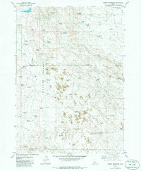
Volcanic terrain and high-desert water management dominate this late 1970s landscape in southern Idaho. The Bennett Hills and Black Butte Hills are marked by extensive lava flows, illustrating the geological character of the Snake River Plain transition. The scarcity of natural surface water is evident in the dense network of small irrigation and stock impoundments, ranging from Summit Reservoir and Granite Butte Reservoir in the north to the Bailing Reservoir and Landmark Reservoir further south.
Find a feature on this map
45 named features on this map. Tap any name to fly to it.
Don’t see what you’re looking for? This feature index may not catch every label — zoom into the map to look around manually.
Map Details
Editions of this 1979 Summit Reservoir Map
2 editions found
Other maps of this area

1955 · Hailey
USGS Topo · 1:250,000

1957 · Thorn Creek SE
USGS Topo · 1:24,000

1957 · Thorn Creek
USGS Topo · 1:62,500

1957 · Bellevue
USGS Topo · 1:62,500

1957 · Blaine
USGS Topo · 1:62,500

1959 · Hailey
USGS Topo · 1:250,000

1962 · Hailey
USGS Topo · 1:250,000

1979 · Shoshone Ice Cave
USGS Topo · 1:24,000
1979 · Kinzie Butte
USGS Topo · 1:24,000
1979 · Mammoth Cave
USGS Topo · 1:24,000