Old Maps of Bonneville County, Idaho for Metal Detecting
Plan your next treasure hunt with 353 historic maps of Bonneville County. Find old homesites, ghost towns, trails, and gathering spots that may be lost to time — perfect for identifying promising metal detecting locations.
- Locate forgotten sites: Uncover places like long-lost settlements, abandoned rail lines, or gathering spots.
- Plan better hunts: Use map overlays combined with LiDAR or satellite views to narrow in on historically rich areas.
- Made for detectorists: Thousands of hobbyists use these maps to discover relics, coins, and hidden history.
Use these historic maps to boost your research and find new opportunities beneath the surface of Bonneville County.
Bonneville County, ID maps
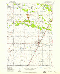
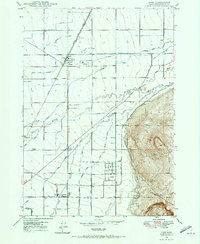
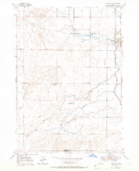
(353)- 1917 Map of Cranes Flat
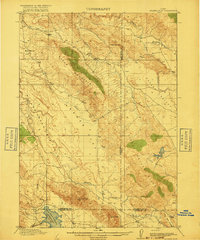 1917 Cranes Flat1917 Print · USGSSoutheast Idaho's high-plateau ranching country is shown here just before the First World War, where mountain ranges separate wide, arid basins. Researchers can locate the early Hancock Ranch and trace the original shoreline of the Blackfoot River Reservoir and Cranes Creek.3 unique versions available
 - 1924 Map of Hell Creek, 1958 Print
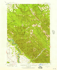
 1924 Hell Creek1958 Print · USGSSoutheast Idaho's high country is captured here during the mid-twenties, showcasing the rural life of Bonneville and Bingham Counties. Genealogists and local historians can trace family-named landmarks like Skelly Hill, the remote Dehlin School, and the early Hell Creek Ranger Station.2 unique versions available
 - 1924 Map of Ammon, 1958 Print
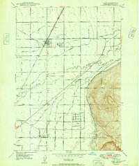
 1924 Ammon1958 Print · USGSSoutheast Idaho at the dawn of the motorized age shows a landscape of developing irrigation and rural schools. You can trace the path of the Union Pacific through Ammon or locate historic schoolhouses like Dewey School and Henry Creek School.3 unique versions available
 - 1926 Map of Hell Creek
 1926 Hell Creek1926 Print · USGSThe ranching and forest lands of eastern Idaho are captured here in the mid-1920s. Researchers can trace the rural infrastructure of the day, from the Dehlin School to the remote Fall Creek Ranger Sta and the waters of Tex Creek.2 unique versions available
 - 1932 Map of Irwin
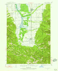
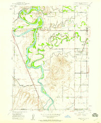
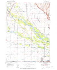
 1932 Irwin1932 Print · USGSThe Snake River corridor and the high mountain basins of eastern Idaho are captured here in the early 1930s. Researchers can trace early river crossings like Edwards Ferry or find small-community landmarks like Rainy Dale and Pumpkin Center Sch.2 unique versions available
 - 1935 Map of Irwin
 1935 Irwin1935 Print · USGSThe Idaho-Wyoming borderlands are captured here in the 1930s as the river economy and mountain ranching defined the region. Researchers can trace the early road networks and rural institutions from Edwards Ferry to local schools like Fidelity Sch and Blowout Sch.3 unique versions available
 - 1943 Map of Driggs, 1955 Print
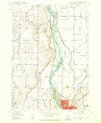
 1943 Driggs1955 Print · USGSTeton Valley during the mid-forties is depicted as a thriving agricultural and rail corridor between the high peaks of the Teton Mountains. Researchers can trace the heritage of local rural life through labels for Bates Sch, Darby Ch, and the Union Pacific line.3 unique versions available
 - 1943 Map of Garns Mtn, 1957 Print
 1943 Garns Mtn1957 Print · USGSEastern Idaho's high ridges and the winding Snake River corridor are captured here during the mid-1940s. Researchers can locate remote industrial sites like the Brown Bear Mine, early education landmarks such as the Upper Pine Creek Sch, and the Durrant Ranch.3 unique versions available
 - 1946 Map of Driggs
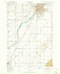
 1946 Driggs1946 Print · USGSThe Teton Valley was a landscape of remote mountain peaks and irrigated ranch land during the mid-forties. Genealogists and historians can trace old homestead sites near Bates Sch and Sorensen or follow the historic Union Pacific rail line between Driggs and Victor.
 - 1946 Map of Garns Mtn
 1946 Garns Mtn1946 Print · USGSHigh-country ranching and coal mining define this Idaho landscape in the 1940s, situated where the Snake River meets the Big Flat. Genealogists and historians can trace family locations at the Durant Ranch or follow the local mining economy through sites like the Mikesell Mine and Pintar Mine.
 - 1948 Map of Woodville, 1954 Print
 1948 Woodville1954 Print · USGSThe eastern Snake River Plain in the late 1940s reveals a landscape split between volcanic fields and irrigation. Genealogists and historians can trace family-named waterworks like the Olson Canal and Hanson Canal near the settlement of Woodville.
 - 1948 Map of Rigby, 1959 Print
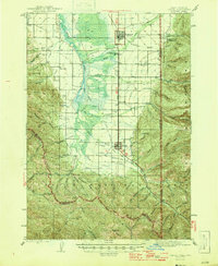
 1948 Rigby1959 Print · USGSThe Upper Snake River Valley comes to life in this post-war survey, showing the agricultural engine of Jefferson County. Genealogists and local historians can trace the irrigation network through dozens of named features like the Rigby Canal or locate landmarks such as Garfield Sch and the Little Buttes.
 - 1948 Map of Lewisville, 1959 Print
 1948 Lewisville1959 Print · USGSSoutheastern Idaho's agricultural heartland is captured here in the late 1940s, showing a complex web of canals and riverfront settlements. Researchers can trace family roots through the Lewisville Cemetery, Midway High Sch, and the rail stops at Roberts and Bassett.3 unique versions available
 - 1948 Map of Idaho Falls North, 1962 Print
 1948 Idaho Falls North1962 Print · USGSIdaho Falls and the surrounding Bonneville County farmlands are seen here just after the war, when irrigation transformed the valley. Genealogists can locate family landmarks like the Coltman Ward Church, St Leon Grange, and rural sites like Payne and Orvin.4 unique versions available
 - 1948 Map of Idaho Falls South, 1965 Print
 1948 Idaho Falls South1965 Print · USGSIn the late 1940s, the area south of Idaho Falls was a thriving agricultural valley defined by a sophisticated irrigation network and the SNAKE RIVER. Genealogists and local historians can trace rural school districts like Stanton Sch and York Sch, alongside landmarks such as the LDS Temple and Fielding Memorial Cem.3 unique versions available
 - 1948 Map of Ucon, 1973 Print
 1948 Ucon1973 Print · USGSUpper Snake River Plain settlements and irrigation networks are shown in detail during the late nineteen-forties. Genealogists and local historians can trace family-named water rights and rural landmarks from St Leon School to Iona and the Lincoln Cem.3 unique versions available
 - 1949 Map of Ucon
 1949 Ucon1949 Print · USGSThe agricultural heart of Bonneville County comes alive in this late-1940s survey of the canal-fed plains north of Idaho Falls. Genealogists and local historians can trace family-named waterworks like Norton Ditch alongside landmarks like St Leon School and Lincoln Cem.
 - 1949 Map of Idaho Falls North
 1949 Idaho Falls North1949 Print · USGSNorth of Idaho Falls in the late 1940s, the Snake River powered a growing agricultural and transit hub. Researchers can trace the development of rural life through the Coltman Ward Church, Sage Creek School, and the vast network of the Great Western Canal.
 - 1949 Map of Rigby
 1949 Rigby1949 Print · USGSJefferson County in the late 1940s is defined by a massive irrigation network surrounding Rigby and Menan. Genealogists and historians can trace the paths of the Union Pacific, locate the Garfield Sch, and study the complex system of the Burgess Canal.3 unique versions available
 - 1949 Map of Lewisville
 1949 Lewisville1949 Print · USGSEastern Idaho's irrigation and rail networks are expertly detailed here in the late 1940s as the Snake River valley prospered. Genealogists and local historians can trace the foundations of Lewisville, locate the Central Cem, and find rural landmarks like Grant School.
 - 1949 Map of Roberts, 1959 Print
 1949 Roberts1959 Print · USGSThe Upper Snake River Plain comes alive in the late 1940s, showing a landscape defined by industrial irrigation and rail-side settlements. Genealogists and historians can trace the foundations of local communities at Lewisville Cem, Grant Sch, and Oakland Valley.
 - 1949 Map of Roberts, 1966 Print
 1949 Roberts1966 Print · USGSIn the Idaho high desert at the close of the 1940s, the village of Roberts stands at the intersection of rail and water. Local researchers can trace the detailed irrigation network of Mc Carthy Ditch and the Union Pacific line as it skirts Market Lake.4 unique versions available
 - 1949 Map of Shattuck Butte, 1973 Print
 1949 Shattuck Butte1973 Print · USGSSoutheastern Idaho at the close of the 1940s reveals a landscape defined by volcanic landmarks and ambitious irrigation projects. Researchers can trace the water network from the Oakland Canal to Shattuck Butte, finding old landmarks like a Quarry and rural Windmill.2 unique versions available
 - 1950 Map of Ririe
 1950 Ririe1950 Print · USGSSoutheast Idaho at mid-century reveals a landscape transformed by the Snake River and its vast irrigation network. Researchers can trace family ties through Ririe and Sunnydell, or locate rural landmarks like Clark Sch and Sutton Cem.3 unique versions available
 - 1950 Map of Shattuck Butte
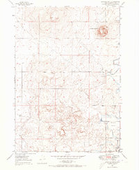
 1950 Shattuck Butte1950 Print · USGSBonneville County in the late 1940s and early 1950s was a landscape defined by industrial quarrying and a complex irrigation network. Genealogists and researchers can trace the water rights and land use of Oakland Valley through markers like Oakland Canal, Shattuck Butte, and the Beckman Ditch.
Showing maps 1-25 of 353
Top cities of Bonneville County
- Idaho Falls historical maps
- Ammon historical maps
- Iona historical maps
- Ucon historical maps
- Swan Valley historical maps
- Irwin historical maps
Frequently asked questions
- What are the different types of historical maps available for Bonneville County?
- What is the oldest map of Bonneville County?
- Where can I purchase historical maps of Bonneville County for my home or office?
- Where can I download high-res historical maps of Bonneville County?
- Are there historical topographic maps available for Bonneville County?
- Is there historical aerial imagery available for Bonneville County?
- Where are historical maps of Bonneville County sourced from?