
1943 Map of Garns Mtn
USGS Topo · Published 1957About this map
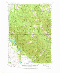
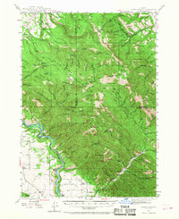
The Snake River carves a deep path through the southwestern corner of this Idaho high-country survey, flanked by the broad expanse of Antelope Flat and Lufkin Bottom. This 1943 mapping reflects a landscape defined by extractive industries and early ranching, with the Durrant Ranch established along the river and the Upper Pine Creek Sch serving the local families in the southern drainage. The northern reaches within the Targhee National Forest reveal a history of coal or phosphate mining, evidenced by the Idaho Mine, Mikesell Mine, and Brown Bear Mine situated near Packsaddle Basin. High peaks such as Garns Mtn and Wheaton Mtn dominate the central terrain, while intricate water systems like Moody Creek and Pine Creek drain the surrounding ridges, providing essential water for the livestock routes indicated by the Sheep Driveway.
Find a feature on this map
97 named features on this map. Tap any name to fly to it.
Don’t see what you’re looking for? This feature index may not catch every label — zoom into the map to look around manually.
Map Details
Editions of this 1943 Garns Mtn Map
3 editions found
Other maps of this area

1924 · Hell Creek
USGS Topo · 1:62,500

1926 · Hell Creek
USGS Topo · 1:62,500

1932 · Irwin
USGS Topo · 1:96,000

1935 · Irwin
USGS Topo · 1:125,000

1943 · Driggs
USGS Topo · 1:62,500

1946 · Driggs
USGS Topo · 1:62,500

1946 · Garns Mtn
USGS Topo · 1:62,500

1951 · Hawley Gulch
USGS Topo · 1:24,000

1951 · Heise SE
USGS Topo · 1:24,000

1951 · White Owl Butte
USGS Topo · 1:24,000