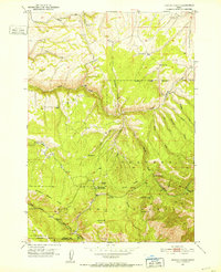
1951 Map of White Owl Butte
USGS Topo · Published 1952About this map
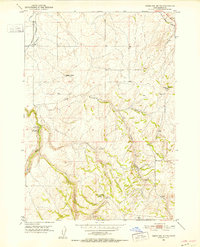
White Owl Butte and the surrounding high country of Madison County define this 1951 landscape, characterized by dramatic drainages and high points. The terrain is marked by the deep winding path of Long Hollow, which cuts through the central portion of the quadrangle toward the Elbow of Moody Creek. This survey, based on 1946 aerial photography, captures the intricate topography of the region before significant modern development, showing the complex network of ridges and draws that separate the various creek systems. Prominent landmarks such as Bitters Butte and Canyon Creek Butte serve as primary navigational points in an area dominated by natural features. The mapping of Canyon Creek and Dry Canyon reveals a landscape where water movement has historically shaped the local geology, providing essential context for understanding the early environmental layout of this part of Idaho.
Find a feature on this map
10 named features on this map. Tap any name to fly to it.
Don’t see what you’re looking for? This feature index may not catch every label — zoom into the map to look around manually.
Map Details
Editions of this 1951 White Owl Butte Map
This is the sole edition of this map. No revisions or reprints were ever made.
Other maps of this area
1943 · Garns Mtn
USGS Topo · 1:62,500

1946 · Garns Mtn
USGS Topo · 1:62,500
1949 · Newdale
USGS Topo · 1:24,000
1950 · Newdale
USGS Topo · 1:24,000
1950 · St Anthony
USGS Topo · 1:24,000
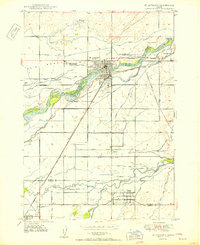
1951 · Moody
USGS Topo · 1:24,000
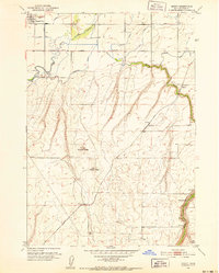
1951 · Hawley Gulch
USGS Topo · 1:24,000
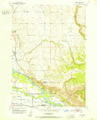
1951 · Heise
USGS Topo · 1:24,000

1955 · Driggs
USGS Topo · 1:250,000

1958 · Driggs
USGS Topo · 1:250,000