
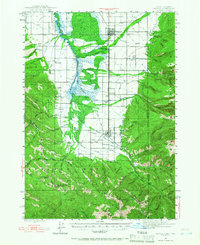
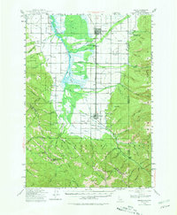
1943 Map of Driggs
USGS Topo · Published 1955About this map
Driggs and Victor anchor this mid-century portrait of Teton Valley, where the Union Pacific railroad corridor parallels the Teton River through a landscape of irrigated agriculture and high mountain wilderness. The map reveals a structured rural society of the 1940s, marked by scattered educational and religious centers such as Bates Sch, Chapin Sch, and the Darby Ch. The complex water management of the valley is evident in the network of irrigation works, including the Kimball Canal, Town Canal, and Spencer Canal, which redirected flows toward family farmsteads.
Find a feature on this map
84 named features on this map. Tap any name to fly to it.
Don’t see what you’re looking for? This feature index may not catch every label — zoom into the map to look around manually.
Map Details
Editions of this 1943 Driggs Map
3 editions found
Other maps of this area

1899 · Grand Teton
USGS Topo · 1:125,000

1901 · Grand Teton
USGS Topo · 1:125,000

1931 · Jackson
USGS Topo · 1:125,000

1932 · Irwin
USGS Topo · 1:96,000

1935 · Irwin
USGS Topo · 1:125,000

1935 · Jackson
USGS Topo · 1:125,000

1943 · Garns Mtn
USGS Topo · 1:62,500

1946 · Driggs
USGS Topo · 1:62,500

1946 · Garns Mtn
USGS Topo · 1:62,500

1955 · Driggs
USGS Topo · 1:250,000