
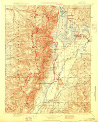
1901 Map of Grand Teton
USGS Topo · Published 1909About this map
Targhee National Forest and Teton National Forest define this early 20th-century landscape, capturing the frontier homesteading era before the establishment of modern park boundaries. The Snake River serves as a central artery for the valley, where travel relied on historic crossings such as Menor Ferry, Conrad Ferry, and the Outlet Ford at the mouth of Jackson Lake.
Find a feature on this map
122 named features on this map. Tap any name to fly to it.
Don’t see what you’re looking for? This feature index may not catch every label — zoom into the map to look around manually.
Map Details
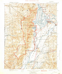
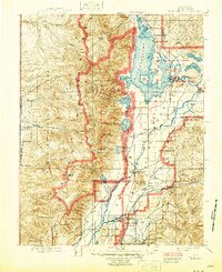
Editions of this 1901 Grand Teton Map
4 editions found
Other maps of this area

1885 · Lake
USGS Topo · 1:125,000

1886 · Shoshone
USGS Topo · 1:125,000

1888 · Shoshone
USGS Topo · 1:125,000

1895 · Shoshone
USGS Topo · 1:125,000

1895 · Lake
USGS Topo · 1:125,000

1896 · Lake
USGS Topo · 1:125,000

1899 · Grand Teton
USGS Topo · 1:125,000

1901 · Shoshone
USGS Topo · 1:125,000

1901 · Lake
USGS Topo · 1:125,000
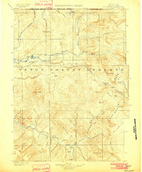
1902 · Mt Leidy
USGS Topo · 1:125,000