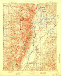
1901 Map of Grand Teton
USGS Topo · Published 1923About this map
The Teton Mountains dominate this early twentieth-century survey, which documents the region's landscape just as it was being designated for protection. This specific edition includes significant red-ink updates from 1929 by the National Park Service, marking the boundaries of the newly established Grand Teton National Park and identifying primary roads. The map reveals a land defined by early ranching homesteads and seasonal lodges before modern infrastructure arrived, with the Snake River winding through the valley past the Menor Ferry Bridge and the Elk Refuge Res.
Find a feature on this map
80 named features on this map. Tap any name to fly to it.
Don’t see what you’re looking for? This feature index may not catch every label — zoom into the map to look around manually.
Map Details
Editions of this 1901 Grand Teton Map
4 editions found
Other maps of this area

1885 · Lake
USGS Topo · 1:125,000

1886 · Shoshone
USGS Topo · 1:125,000

1888 · Shoshone
USGS Topo · 1:125,000

1895 · Shoshone
USGS Topo · 1:125,000

1895 · Lake
USGS Topo · 1:125,000

1896 · Lake
USGS Topo · 1:125,000

1899 · Grand Teton
USGS Topo · 1:125,000

1901 · Shoshone
USGS Topo · 1:125,000

1901 · Lake
USGS Topo · 1:125,000

1901 · Grand Teton
USGS Topo · 1:125,000