Old Maps of Lost River, Idaho for Metal Detecting
Plan your next treasure hunt with 37 historic maps of Lost River. Find old homesites, ghost towns, trails, and gathering spots that may be lost to time — perfect for identifying promising metal detecting locations.
- Locate forgotten sites: Uncover places like long-lost settlements, abandoned rail lines, or gathering spots.
- Plan better hunts: Use map overlays combined with LiDAR or satellite views to narrow in on historically rich areas.
- Made for detectorists: Thousands of hobbyists use these maps to discover relics, coins, and hidden history.
Use these historic maps to boost your research and find new opportunities beneath the surface of Lost River.
Lost River, ID maps
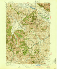
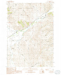
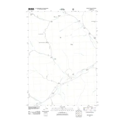
(37)- 1935 Map of MacKay
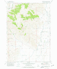
 1935 MacKay1935 Print · USGSCuster County was a rugged center of mining and irrigation in the mid-1930s. Genealogists and historians can trace high-altitude homesteads and industry through Mackay, the Star O Hope Mine, and rural schools like Franklin Sch.
 - 1940 Map of Mackay
 1940 Mackay1940 Print · USGSCuster and Butte counties are captured here in the late 1930s, showing a landscape defined by irrigation ditches and high-altitude mining. You can trace the development of the Big Lost River valley, finding early schools like Barton Sch and remote mountain sites like Leadbelt Mine.2 unique versions available
 - 1955 Map of Idaho Falls, 1963 Print
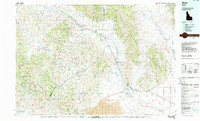
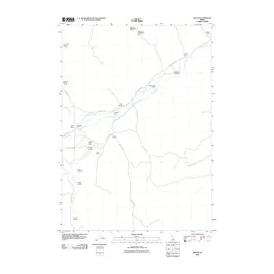
 1955 Idaho Falls1963 Print · USGSThe Snake River Plain and its surrounding volcanic peaks are captured in the late fifties, showing the region's unique mix of nuclear research and high-desert ranching. Trace the industrial footprint of the National Reactor Testing Station or find old mining sites like Empire Mine.5 unique versions available
 - 1958 Map of Idaho Falls
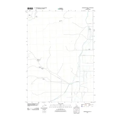
 1958 Idaho Falls1958 Print · USGSEastern Idaho in the late fifties showcases the rapid expansion of agricultural and scientific outposts across its volcanic plains. Researchers can locate remote sites like Atomic City, mineral interests at White Knob Mine, and the cultural grounds of St Marys Mission.2 unique versions available
 - 1960 Map of Grouse, 1961 Print
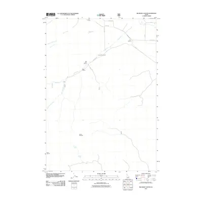
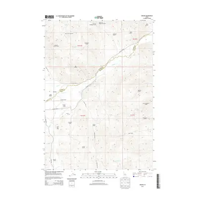
 1960 Grouse1961 Print · USGSAntelope Valley in the early 1960s was a landscape of remote mountain ranches and fading mining camps. Researchers can trace the heritage of vanished settlements at Martin (Site) or locate family landmarks like the Brockie Ranch and Antelope Cem.2 unique versions available
 - 1960 Map of Mackay, 1962 Print
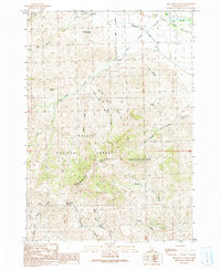
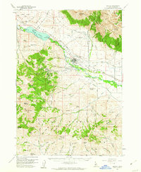 1960 Mackay1962 Print · USGSMackay and the Big Lost River Valley are shown at a peak of mining and rail activity in the early sixties. Researchers can trace the legacy of the Empire Mine and Darlington Shaft or locate historic burials at Battleground Cem and Nigger Hill Cem.2 unique versions available
 - 1969 Map of Darlington, 1973 Print
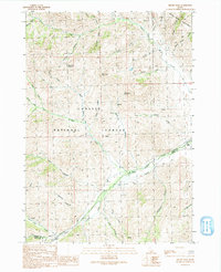
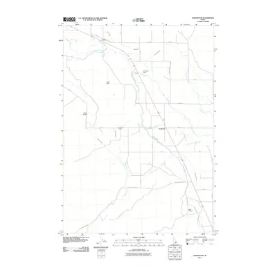
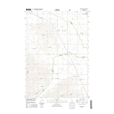
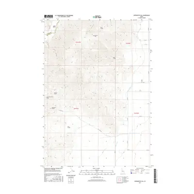
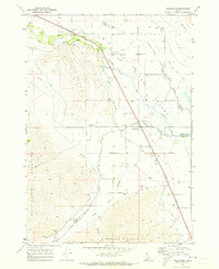 1969 Darlington1973 Print · USGSThe Big Lost River Valley in the late sixties reveals a landscape defined by complex irrigation and small rail-side settlements. Genealogists and historians can trace water rights and local landmarks like the Darlington Cem, the Union Ditch, and the aptly named Appendicitis Hill.2 unique versions available
 - 1972 Map of Appendicitis Hill, 1977 Print
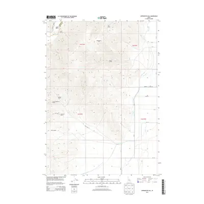
 1972 Appendicitis Hill1977 Print · USGSThe high desert of Butte County during the early 1970s shows a landscape of mountain canyons meeting the irrigated valley floor. Trace local genealogy and ranching history through the Lost River Cem, the Corral, and Sorensen Spring along the river.
 - 1988 Map of Arco, 1989 Print
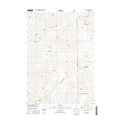
 1988 Arco1989 Print · USGSThe Big Lost River Valley thrived as a high-altitude ranching and agricultural hub in the late eighties. Researchers can trace the Union Pacific line to Arco or locate smaller rural communities like Houston, Moore, and Butte City.
 - 1991 Map of Big Blind Canyon
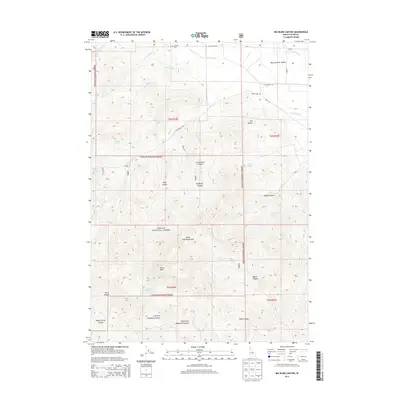
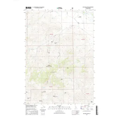
 1991 Big Blind Canyon1991 Print · USGSCuster County’s high country is captured here during the early nineties, centered on the dramatic rise from the Big Lost River Valley into the White Mountains. Genealogists and researchers can locate the Houston Cemetery and trace early land use through named sites like Fallini Spring and Slaughterhouse Springs.
 - 1991 Map of Miller Peak
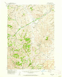
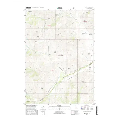
 1991 Miller Peak1991 Print · USGSCuster and Butte County high country is shown here in the 1990s as a landscape of forest management and early prospecting. Trace the paths of 4WD tracks through Bear Creek Summit and locate landmarks like the Antelope FS Station or the Prospect near Iron Bog Creek.
 - 1991 Map of Grouse
 1991 Grouse1991 Print · USGSAntelope Valley and the high Idaho desert are captured here in the early nineties, showing a landscape of deep canyons and seasonal waterways. Genealogists and local historians can locate Grouse, trace the Antelope Cem, and explore the rugged White Knob Mountains.
 - 2010 Map of Grouse, 2010 Print
 2010 Grouse2010 Print · USGSCovers Lost River, including Custer County, Butte County, and other nearby areas
 - 2010 Map of Appendicitis Hill, 2010 Print
 2010 Appendicitis Hill2010 Print · USGSCovers Lost River, including Custer County, Butte County, and other nearby areas
 - 2011 Map of Big Blind Canyon, 2011 Print
 2011 Big Blind Canyon2011 Print · USGSCovers Lost River, including Custer County, United States, and other nearby areas
 - 2011 Map of Miller Peak, 2011 Print
 2011 Miller Peak2011 Print · USGSCovers Lost River, including Custer County, Butte County, and other nearby areas
 - 2011 Map of Darlington, 2011 Print
 2011 Darlington2011 Print · USGSCovers Lost River, including Leslie, Custer County, and other nearby areas
 - 2013 Map of Miller Peak, 2013 Print
 2013 Miller Peak2013 Print · USGSCovers Lost River, including Custer County, Butte County, and other nearby areas
 - 2013 Map of Big Blind Canyon, 2013 Print
 2013 Big Blind Canyon2013 Print · USGSCovers Lost River, including Custer County, United States, and other nearby areas
 - 2013 Map of Grouse, 2013 Print
 2013 Grouse2013 Print · USGSCovers Lost River, including Custer County, Butte County, and other nearby areas
 - 2013 Map of Appendicitis Hill, 2013 Print
 2013 Appendicitis Hill2013 Print · USGSCovers Lost River, including Custer County, Butte County, and other nearby areas
 - 2013 Map of Darlington, 2013 Print
 2013 Darlington2013 Print · USGSCovers Lost River, including Leslie, Custer County, and other nearby areas
 - 2017 Map of Miller Peak, 2017 Print
 2017 Miller Peak2017 Print · USGSCovers Lost River, including Custer County, Butte County, and other nearby areas
 - 2017 Map of Appendicitis Hill, 2017 Print
 2017 Appendicitis Hill2017 Print · USGSCovers Lost River, including Custer County, Butte County, and other nearby areas
 - 2017 Map of Big Blind Canyon, 2017 Print
 2017 Big Blind Canyon2017 Print · USGSCovers Lost River, including Custer County, United States, and other nearby areas
Showing maps 1-25 of 37
Top cities near Lost River
Frequently asked questions
- What are the different types of historical maps available for Lost River?
- What is the oldest map of Lost River?
- Where can I purchase historical maps of Lost River for my home or office?
- Where can I download high-res historical maps of Lost River?
- Are there historical topographic maps available for Lost River?
- Is there historical aerial imagery available for Lost River?
- Where are historical maps of Lost River sourced from?