Old Maps of Grangeville, Idaho
Explore 17 old maps of Grangeville, spanning from 1955 to today. These high-resolution historic maps reveal how streets, neighborhoods, landmarks, and natural features evolved over time — perfect for genealogy, metal detecting, research, and local history exploration.
What you can do with these maps:
- See how Grangeville changed over time: Compare historical maps to modern-day views to trace roads, homesites, rail lines & more.
- View detailed metadata: Each map includes creators, publishers, year, scale, and archive source.
- Overlay maps with satellite & LiDAR: Visualize the past alongside modern tools to explore terrain & human change.
- Trusted historical sources: Maps sourced from the USGS, Library of Congress, and other archives.
- Access maps your way: View online, download high-res files, or order prints for personal or research use.
Start exploring old maps of Grangeville to uncover forgotten places, hidden landmarks, and the deep history beneath your feet.
Grangeville, ID maps
(17)- 1955 Map of Grangeville, 1964 Print
 1955 Grangeville1964 Print · USGSThe high country of the Idaho-Oregon border comes alive in the mid-1950s, showing the deep river canyons and mountain peaks. Trace the Union Pacific RR through the valleys or locate settlements like Grangeville, Joseph, and the shoreline of Wallowa Lake.4 unique versions available
 - 1959 Map of Grangeville
 1959 Grangeville1959 Print · USGSThe high alpine peaks and deep river canyons of the Idaho-Oregon borderlands are captured in the late fifties. Researchers can trace the Union Pacific RR through the valleys to settlements like Enterprise, Union, and Grangeville.2 unique versions available
 - 1963 Map of Grangeville West, 1964 Print
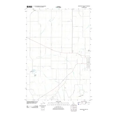
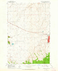 1963 Grangeville West1964 Print · USGSGrangeville and its Idaho County environs are captured here in the early sixties, showing the town at the edge of the Camas Prairie. Researchers can trace local landmarks like Tolo Lake, the County Airport, and the small settlement of Denver.2 unique versions available
 - 1963 Map of Grangeville East, 1965 Print
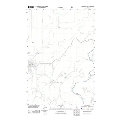
 1963 Grangeville East1965 Print · USGSGrangeville and the surrounding Camas Prairie are captured in the early sixties as the regional hub transitioned into a modern era. Researchers can locate family landmarks like Fairview Cem, the site of the Dewey Mine, and the mid-century Drive-in Theater.
 - 1980 Map of Grangeville
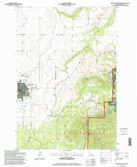
 1980 Grangeville1980 Print · USGSGrangeville and the surrounding Camas Prairie are captured in the late twentieth century as the region balanced agriculture with its deep mining roots. Discover the locations of the Dewey Mine, the remote settlement of Florence, and the winding path of the Salmon River.
 - 1995 Map of Grangeville East, 1999 Print
 1995 Grangeville East1999 Print · USGSGrangeville and the surrounding Camas Prairie landscape are captured here in the mid-1990s as the town expanded toward the national forest. Researchers can locate the Fairview Cemetery, trace the Dewey Mine, or find the historic County Farm and Mount Idaho.
 - 1995 Map of Grangeville West, 1999 Print
 1995 Grangeville West1999 Print · USGSThe Camas Prairie of the mid-1990s unfolds around Grangeville, showing the intersection of rural agriculture and growing civic infrastructure. Researchers can trace family landmarks along Trueblood Lane, locate the historic waters of Tolo Lake, or study the layout of the County Airport.
 - 2010 Map of Grangeville West, 2010 Print
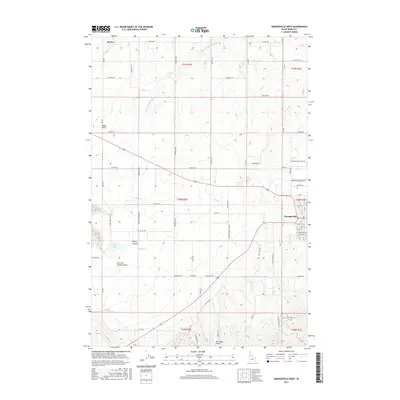
 2010 Grangeville West2010 Print · USGSCovers Grangeville, including Idaho County, United States, and other nearby areas
 - 2011 Map of Grangeville East, 2011 Print
 2011 Grangeville East2011 Print · USGSCovers Grangeville, including Mount Idaho, Idaho County, and other nearby areas
 - 2013 Map of Grangeville West, 2013 Print
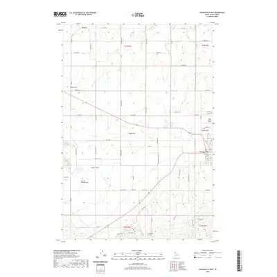
 2013 Grangeville West2013 Print · USGSCovers Grangeville, including Idaho County, United States, and other nearby areas
 - 2013 Map of Grangeville East, 2013 Print
 2013 Grangeville East2013 Print · USGSCovers Grangeville, including Mount Idaho, Idaho County, and other nearby areas
 - 2017 Map of Grangeville West, 2017 Print
 2017 Grangeville West2017 Print · USGSCovers Grangeville, including Idaho County, United States, and other nearby areas
 - 2017 Map of Grangeville East, 2017 Print
 2017 Grangeville East2017 Print · USGSCovers Grangeville, including Mount Idaho, Idaho County, and other nearby areas
 - 2020 Map of Grangeville West, 2020 Print
 2020 Grangeville West2020 Print · USGSCovers Grangeville, including Idaho County, United States, and other nearby areas
 - 2020 Map of Grangeville East, 2020 Print
 2020 Grangeville East2020 Print · USGSCovers Grangeville, including Mount Idaho, Idaho County, and other nearby areas
 - 2024 Map of Grangeville West, 2024 Print
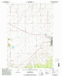
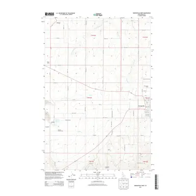
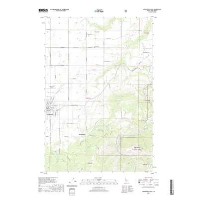
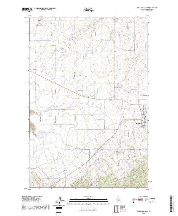 2024 Grangeville West2024 Print · USGSGrangeville and the surrounding Camas Prairie are documented in the early twenty-first century, showing the intersection of town life and high-plateau agriculture. Genealogists and local historians can trace family-named routes and landmarks like Denver, Tolo Lake, and the Idaho County Airport.
 - 2024 Map of Grangeville East, 2024 Print
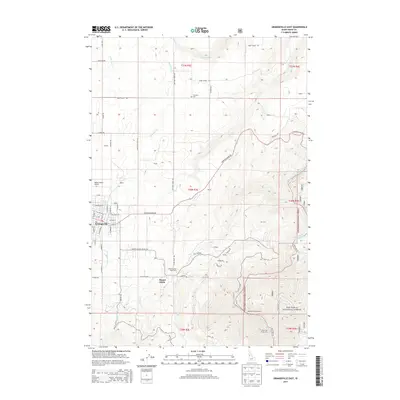
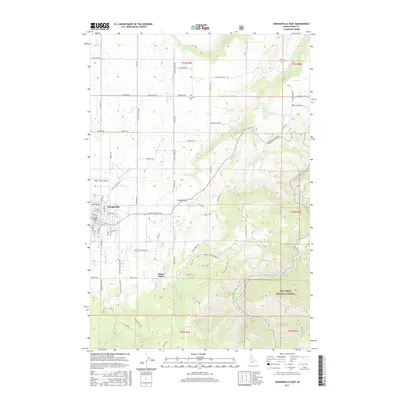
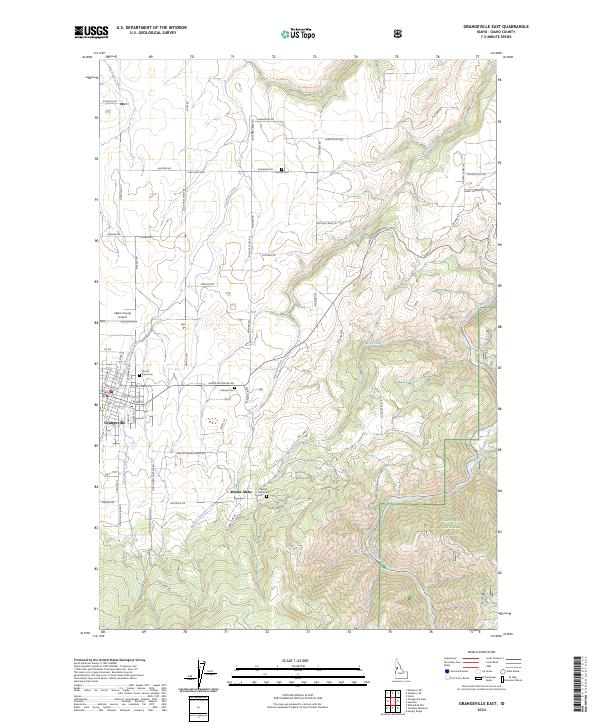 2024 Grangeville East2024 Print · USGSGrangeville and the Camas Prairie region are captured in the early twenty-first century, showing the transition from town to forest. Researchers can trace local heritage through the Mount Idaho Cem, Idaho County Airport, and Mount Idaho settlement.
End of results
Showing maps 1-17 of 17
Top cities near Grangeville
Frequently asked questions
- What are the different types of historical maps available for Grangeville?
- What is the oldest map of Grangeville?
- Where can I purchase historical maps of Grangeville for my home or office?
- Where can I download high-res historical maps of Grangeville?
- Are there historical topographic maps available for Grangeville?
- Is there historical aerial imagery available for Grangeville?
- Where are historical maps of Grangeville sourced from?