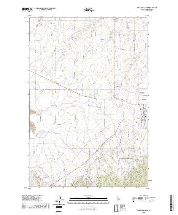
2024 Map of Grangeville West
USGS Topo · Published 2024About this map
Grangeville serves as the primary hub in this Idaho landscape, where the grid of city streets like Hill St and Court St meets the rural agricultural expanse of the Camas Prairie. To the northwest, the small community of Denver marks an area of historical significance, connected by Denver Rd and Denver Cemetary Rd. The terrain is defined by a transition from the level plateau supporting the Idaho County Airport to the beginning of more varied topography near Wind Ridge. Water features dictate much of the land use, with Tolo Lake providing a significant natural landmark in the southwest, while drainage is managed by a network of waterways including Johns Creek, Telcher Creek, and the South Fork Cottonwood Creek. The township and range lines of the Public Land Survey System overlay a landscape increasingly fragmented by roads such as Canyon Rd and Powerline Rd.
Find a feature on this map
102 named features on this map. Tap any name to fly to it.
Don’t see what you’re looking for? This feature index may not catch every label — zoom into the map to look around manually.
Map Details
Editions of this 2024 Grangeville West Map
This is the sole edition of this map. No revisions or reprints were ever made.
Other maps of this area

1924 · Kamiah
USGS Topo · 1:125,000

1955 · Pullman
USGS Topo · 1:250,000

1955 · Grangeville
USGS Topo · 1:250,000

1958 · Pullman
USGS Topo · 1:250,000

1959 · Grangeville
USGS Topo · 1:250,000

1963 · Goodwin Meadows
USGS Topo · 1:24,000

1963 · Grangeville West
USGS Topo · 1:24,000

1963 · White Bird Hill
USGS Topo · 1:24,000
1963 · Grangeville East
USGS Topo · 1:24,000

1963 · White Bird
USGS Topo · 1:24,000