
1963 Map of White Bird Hill
USGS Topo · Published 1965About this map
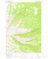
White Bird Hill dominates this landscape in central Idaho, where the high-altitude terrain is carved by an intricate network of drainages and ridges within the Nez Perce National Forest. The 1963 field check reveals a remote area defined by significant elevation changes, from the White Bird Hill Summit and its associated Radio Facility down to the deep valleys of White Bird Creek. Historically, the map documents a land use pattern of high-country grazing and transit, noted by the presence of Chase Meadow, Burnt Flats, and Service Flats. Local family or descriptive names are preserved on landmarks such as Bentz Ridge, Dentist Parlor Ridge, and Poe Saddle. While largely undeveloped, evidence of small-scale industry appears in the form of several Gravel Pits and a network of Trails and Jeep Trails that provided access to the timber and range of the Salmon River country.
Find a feature on this map
39 named features on this map. Tap any name to fly to it.
Don’t see what you’re looking for? This feature index may not catch every label — zoom into the map to look around manually.
Map Details
Editions of this 1963 White Bird Hill Map
2 editions found
Other maps of this area

1955 · Grangeville
USGS Topo · 1:250,000

1959 · Grangeville
USGS Topo · 1:250,000

1963 · McKinzie Creek
USGS Topo · 1:24,000

1963 · Goodwin Meadows
USGS Topo · 1:24,000

1963 · Grangeville West
USGS Topo · 1:24,000

1963 · Slate Creek
USGS Topo · 1:24,000
1963 · Grangeville East
USGS Topo · 1:24,000
1963 · Dairy Mountain
USGS Topo · 1:24,000

1963 · White Bird
USGS Topo · 1:24,000
1963 · Fenn
USGS Topo · 1:24,000