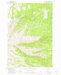
1963 Map of White Bird Hill
USGS Topo · Published 1982About this map
White Bird Hill dominates this Idaho County landscape, a prominent ridge marked by steep canyons and family-named draws. The 1963 survey, updated with 1981 revisions, documents the high-altitude terrain north of the Salmon River where the Nez Perce National Forest boundary cuts across complex drainage systems. Named features like Harrison Johnson Draw and Jimmie Thompson Draw suggest a history of local land use and homesteading in an area defined by significant elevation changes.
Find a feature on this map
35 named features on this map. Tap any name to fly to it.
Don’t see what you’re looking for? This feature index may not catch every label — zoom into the map to look around manually.
Map Details
Editions of this 1963 White Bird Hill Map
2 editions found
Other maps of this area

1955 · Grangeville
USGS Topo · 1:250,000

1959 · Grangeville
USGS Topo · 1:250,000

1963 · McKinzie Creek
USGS Topo · 1:24,000

1963 · Goodwin Meadows
USGS Topo · 1:24,000

1963 · Grangeville West
USGS Topo · 1:24,000

1963 · White Bird Hill
USGS Topo · 1:24,000

1963 · Slate Creek
USGS Topo · 1:24,000
1963 · Grangeville East
USGS Topo · 1:24,000
1963 · Dairy Mountain
USGS Topo · 1:24,000

1963 · White Bird
USGS Topo · 1:24,000