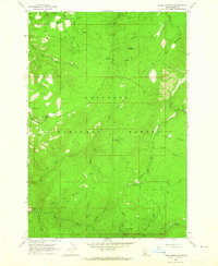
1963 Map of Dairy Mountain
USGS Topo · Published 1965About this map
Nez Perce National Forest dominates this mid-century topographic survey, documenting a wilderness managed through a network of administrative outposts and early fire-management infrastructure. Federal presence is marked by the Skookumchuck Work Center and Adams Work Center, alongside the historical Fenn Cabin near its namesake Fenn Cabin Spring. The drainage patterns of Slate Creek and North Fork Skookumchuck Creek define the landscape, revealing how forest rangers and early travelers navigated the high ridges, such as Dairy Mountain and Asbestos Peak.
Find a feature on this map
42 named features on this map. Tap any name to fly to it.
Don’t see what you’re looking for? This feature index may not catch every label — zoom into the map to look around manually.
Map Details
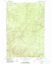
Editions of this 1963 Dairy Mountain Map
2 editions found
Other maps of this area

1931 · Buffalo Hump
USGS Topo · 1:125,000

1934 · Buffalo Hump
USGS Topo · 1:125,000

1955 · Grangeville
USGS Topo · 1:250,000

1956 · Elk City
USGS Topo · 1:250,000

1959 · Grangeville
USGS Topo · 1:250,000

1960 · Elk City
USGS Topo · 1:250,000

1963 · John Day Mtn
USGS Topo · 1:24,000

1963 · McKinzie Creek
USGS Topo · 1:24,000

1963 · Goodwin Meadows
USGS Topo · 1:24,000

1963 · Hanover Mtn.
USGS Topo · 1:24,000