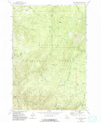
1963 Map of Dairy Mountain
USGS Topo · Published 1993About this map
Nez Perce National Forest land defines this portion of Idaho County, documented during a mid-century field check of the Salmon River backcountry. The landscape is characterized by a dense network of watercourses and high ridges, including Dairy Mountain and Asbestos Peak. Administrative and recreational activity is visible through the presence of the Skookumchuck Work Center and the Adams Work Center, alongside the North Fork Campground. Historically-minded researchers can find evidence of small-scale extraction at the Prospects near Asbestos Creek, while the Peter Ready Trail and various four-wheel-drive tracks suggest the era's movement through these woods. Named water sources like Fenn Cabin Spring and Pig Foot Spring point to localized landmarks used by foresters and early travelers near the Gospel Hump Wilderness border.
Find a feature on this map
41 named features on this map. Tap any name to fly to it.
Don’t see what you’re looking for? This feature index may not catch every label — zoom into the map to look around manually.
Map Details
Editions of this 1963 Dairy Mountain Map
2 editions found
Other maps of this area

1931 · Buffalo Hump
USGS Topo · 1:125,000

1934 · Buffalo Hump
USGS Topo · 1:125,000

1955 · Grangeville
USGS Topo · 1:250,000

1956 · Elk City
USGS Topo · 1:250,000

1959 · Grangeville
USGS Topo · 1:250,000

1960 · Elk City
USGS Topo · 1:250,000

1963 · John Day Mtn
USGS Topo · 1:24,000

1963 · McKinzie Creek
USGS Topo · 1:24,000

1963 · Goodwin Meadows
USGS Topo · 1:24,000

1963 · Hanover Mtn.
USGS Topo · 1:24,000