
1963 Map of John Day Mtn
USGS Topo · Published 1964About this map
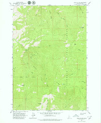
Nez Perce National Forest dominates this mid-century landscape in Idaho County, revealing a high-elevation wilderness defined by steep drainages and fire observation points. In the early 1960s, a lone Lookout Tower stood atop Slate Point, guarding the vast timberlands. The terrain is structured by prominent landforms like John Day Mountain and Allison Ridge, while high-altitude water sources such as Nut Basin Lake dot the upper basins. The drainage network is particularly dense here, with John Day Creek and its many tributaries, including the East Fork, carving deep paths through the forest. This area remains largely undeveloped, served only by primitive transportation routes like the Jeep Trail and other unnamed hiking trails, which provided the only access for forest management and back-country navigation during this era.
Find a feature on this map
27 named features on this map. Tap any name to fly to it.
Don’t see what you’re looking for? This feature index may not catch every label — zoom into the map to look around manually.
Map Details
Editions of this 1963 John Day Mtn Map
2 editions found
Other maps of this area

1938 · Riggins
USGS Topo · 1:96,000

1945 · Riggins
USGS Topo · 1:125,000

1955 · Grangeville
USGS Topo · 1:250,000

1959 · Grangeville
USGS Topo · 1:250,000

1963 · Lucile
USGS Topo · 1:24,000

1963 · McKinzie Creek
USGS Topo · 1:24,000

1963 · Slate Creek
USGS Topo · 1:24,000
1963 · Dairy Mountain
USGS Topo · 1:24,000
1963 · Florence
USGS Topo · 1:24,000

1964 · Riggins
USGS Topo · 1:24,000