Old Maps of Lucile, Idaho for Academic Research
Study the evolution of Lucile with 11 high-resolution historic maps. Whether you're teaching, researching, or modeling changes in land use, these maps provide essential visual documentation of urban, environmental, and geographic change.
- Analyze long-term change: Track patterns in development, transportation, and natural features.
- Ideal for environmental or urban studies: Support academic projects with primary historical map data.
- Use in the classroom or lab: Educators and researchers rely on these maps to bring historical context to life.
These maps are a powerful tool for teaching, research, and visualizing how Lucile has changed over the decades.
Lucile, ID maps
(11)- 1955 Map of Grangeville, 1964 Print
 1955 Grangeville1964 Print · USGSThe high country of the Idaho-Oregon border comes alive in the mid-1950s, showing the deep river canyons and mountain peaks. Trace the Union Pacific RR through the valleys or locate settlements like Grangeville, Joseph, and the shoreline of Wallowa Lake.4 unique versions available
 - 1959 Map of Grangeville
 1959 Grangeville1959 Print · USGSThe high alpine peaks and deep river canyons of the Idaho-Oregon borderlands are captured in the late fifties. Researchers can trace the Union Pacific RR through the valleys to settlements like Enterprise, Union, and Grangeville.2 unique versions available
 - 1963 Map of Lucile, 1964 Print
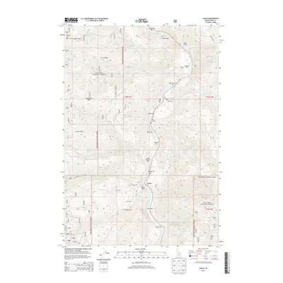
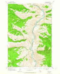 1963 Lucile1964 Print · USGSIdaho’s Salmon River canyon is captured here in the early sixties, showing a landscape of rugged river bars and forest trails. Researchers can find old mining sites like McKinley Mine, the Cow Creek Sch, and the Chief Joseph War Historical Marker near Lucile.2 unique versions available
 - 1980 Map of Grangeville
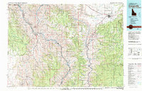 1980 Grangeville1980 Print · USGSGrangeville and the surrounding Camas Prairie are captured in the late twentieth century as the region balanced agriculture with its deep mining roots. Discover the locations of the Dewey Mine, the remote settlement of Florence, and the winding path of the Salmon River.
 - 1995 Map of Lucile, 1999 Print
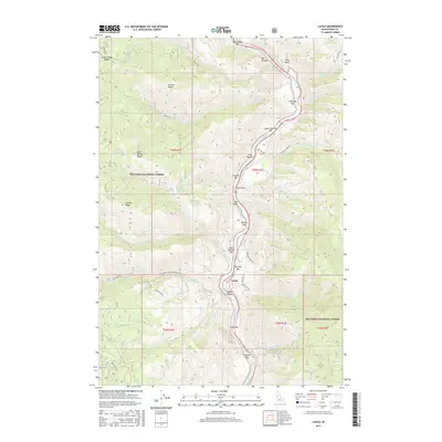
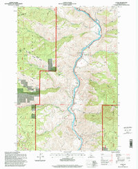 1995 Lucile1999 Print · USGSThe Salmon River canyon in the mid-1990s reveals a landscape of isolated river bars and mountain mining claims within the Nez Perce National Forest. Genealogists and historians can trace the small community of Lucile, find the McKinley Mine, and locate the Chief Joseph War Historical Marker.
 - 2011 Map of Lucile, 2011 Print
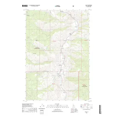
 2011 Lucile2011 Print · USGSCovers Lucile, including Idaho County, United States, and other nearby areas
 - 2013 Map of Lucile, 2013 Print
 2013 Lucile2013 Print · USGSCovers Lucile, including Idaho County, United States, and other nearby areas
 - 2017 Map of Lucile, 2017 Print
 2017 Lucile2017 Print · USGSCovers Lucile, including Idaho County, United States, and other nearby areas
 - 2020 Map of Lucile, 2020 Print
 2020 Lucile2020 Print · USGSCovers Lucile, including Idaho County, United States, and other nearby areas
 - 2023 Map of Lucile, 2023 Print
 2023 Lucile2023 Print · USGSCovers Lucile, including Idaho County, United States, and other nearby areas
 - 2024 Map of Lucile, 2024 Print
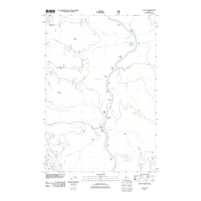
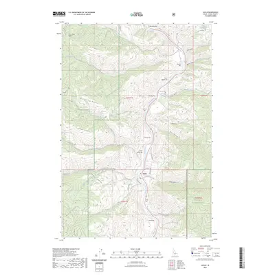
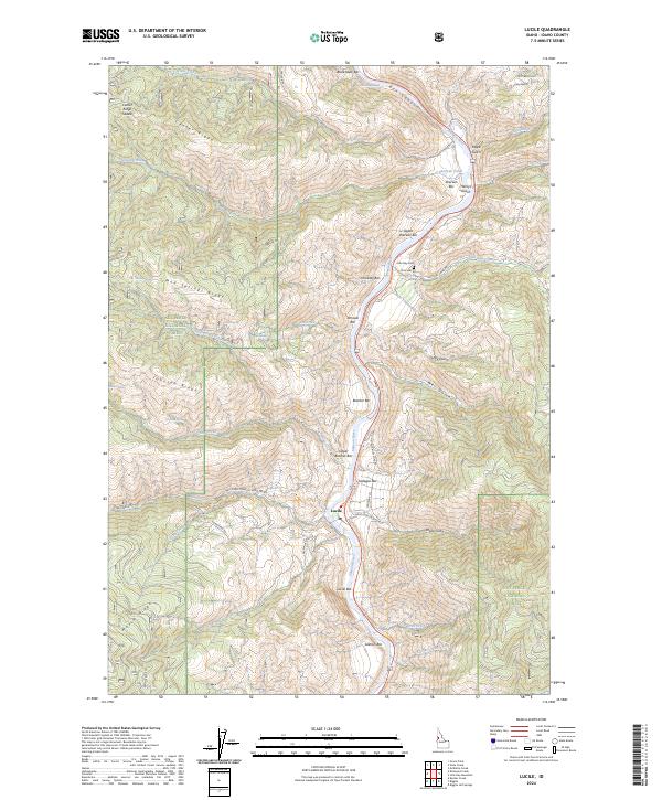 2024 Lucile2024 Print · USGSCentering on the Salmon River canyon in the twenty-first century, this Idaho landscape reveals a remote network of riverside bars and high timbered ridges. Researchers can trace the legacy of canyon ranching and mining through sites like John Day Cem, McKinley Mine Rd, and Seven U Ranch Rd.
End of results
Showing maps 1-11 of 11
Top cities near Lucile
Frequently asked questions
- What are the different types of historical maps available for Lucile?
- What is the oldest map of Lucile?
- Where can I purchase historical maps of Lucile for my home or office?
- Where can I download high-res historical maps of Lucile?
- Are there historical topographic maps available for Lucile?
- Is there historical aerial imagery available for Lucile?
- Where are historical maps of Lucile sourced from?