Old Maps of Hamer, Idaho for Hiking & Exploration
Hike through history with 9 historic maps of Hamer. Explore old trails, ghost towns, and forgotten backroads — perfect for outdoor adventurers and local explorers.
- Rediscover forgotten places: Map out old mining camps, roads, and footpaths that no longer exist on modern maps.
- Layer with modern tools: Combine with LiDAR or satellite views to plan hikes through historical terrain.
- Made for exploration: Popular among hikers, overlanders, and local history lovers.
Use these maps to find adventure and explore the hidden past of Hamer.
Hamer, ID maps
(9)- 1955 Map of Idaho Falls, 1963 Print
 1955 Idaho Falls1963 Print · USGSThe Snake River Plain and its surrounding volcanic peaks are captured in the late fifties, showing the region's unique mix of nuclear research and high-desert ranching. Trace the industrial footprint of the National Reactor Testing Station or find old mining sites like Empire Mine.5 unique versions available
 - 1958 Map of Idaho Falls
 1958 Idaho Falls1958 Print · USGSEastern Idaho in the late fifties showcases the rapid expansion of agricultural and scientific outposts across its volcanic plains. Researchers can locate remote sites like Atomic City, mineral interests at White Knob Mine, and the cultural grounds of St Marys Mission.2 unique versions available
 - 1964 Map of Hamer, 1966 Print
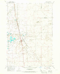 1964 Hamer1966 Print · USGSHamer thrived as a transportation and irrigation hub in eastern Idaho during the mid-1960s. Genealogists and local historians can trace the town's development along the Union Pacific tracks and explore the wetlands of the Camas National Wildlife Refuge.2 unique versions available
 - 1980 Map of Circular Butte
 1980 Circular Butte1980 Print · USGSEastern Idaho at the start of the eighties shows a landscape of federal research and agricultural expansion. Trace the growth of nuclear history at the Idaho National Engineering Laboratory and early settlements like Monteview, Terreton, and Sage Junction.
 - 2010 Map of Hamer, 2010 Print
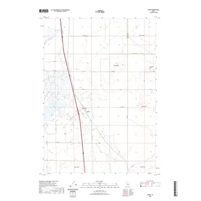
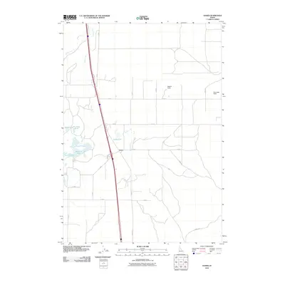 2010 Hamer2010 Print · USGSCovers Hamer, including Jefferson County, Fremont County, and other nearby areas
 - 2013 Map of Hamer, 2013 Print
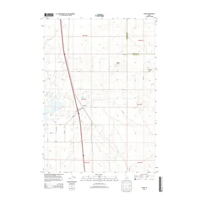 2013 Hamer2013 Print · USGSCovers Hamer, including Jefferson County, Fremont County, and other nearby areas
 - 2017 Map of Hamer, 2017 Print
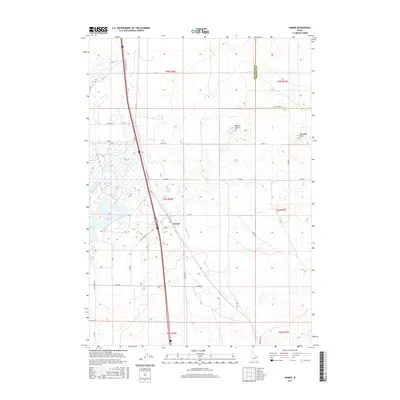 2017 Hamer2017 Print · USGSCovers Hamer, including Jefferson County, Fremont County, and other nearby areas
 - 2020 Map of Hamer, 2020 Print
 2020 Hamer2020 Print · USGSCovers Hamer, including Jefferson County, Fremont County, and other nearby areas
 - 2024 Map of Hamer, 2024 Print
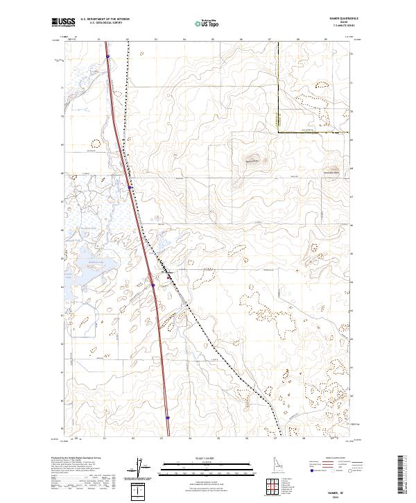 2024 Hamer2024 Print · USGSHamer and the surrounding Jefferson County marshlands are captured in this recent survey, showcasing the area's unique wetland ecology. Genealogists and researchers can trace the roads around Hamer and explore landmarks like Beacon Butte and the Camas National Wildlife Refuge.
End of results
Showing maps 1-9 of 9
Top cities near Hamer
Frequently asked questions
- What are the different types of historical maps available for Hamer?
- What is the oldest map of Hamer?
- Where can I purchase historical maps of Hamer for my home or office?
- Where can I download high-res historical maps of Hamer?
- Are there historical topographic maps available for Hamer?
- Is there historical aerial imagery available for Hamer?
- Where are historical maps of Hamer sourced from?