Old Maps of Jerome County, Idaho for Academic Research
Study the evolution of Jerome County with 134 high-resolution historic maps. Whether you're teaching, researching, or modeling changes in land use, these maps provide essential visual documentation of urban, environmental, and geographic change.
- Analyze long-term change: Track patterns in development, transportation, and natural features.
- Ideal for environmental or urban studies: Support academic projects with primary historical map data.
- Use in the classroom or lab: Educators and researchers rely on these maps to bring historical context to life.
These maps are a powerful tool for teaching, research, and visualizing how Jerome County has changed over the decades.
Jerome County, ID maps
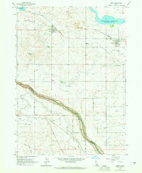
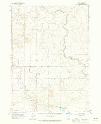
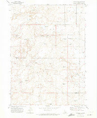
(134)- 1950 Map of Filer, 1952 Print
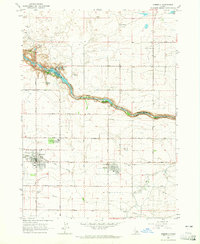
 1950 Filer1952 Print · USGSThe irrigated farmlands of the Magic Valley are captured here during a period of steady post-war growth. Genealogists and local historians can locate early rural landmarks like Maroa School, the IOOF Cem, and the Knull Grange along the Union Pacific tracks.2 unique versions available
 - 1950 Map of Jerome, 1959 Print
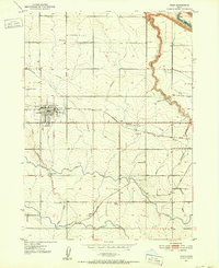
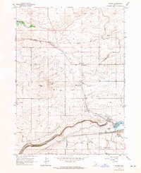
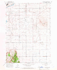
 1950 Jerome1959 Print · USGSJerome and the surrounding Magic Valley countryside are shown here at mid-century, defined by a complex network of irrigation ditches and the deep canyon of the Snake River. Genealogists and local historians can locate early landmarks like Appleton School, Sonnickson Butte, and the Jerome town center.2 unique versions available
 - 1950 Map of Jerome, 1959 Print
 1950 Jerome1959 Print · USGSThe Magic Valley agricultural landscape is captured here in the 1950s, showing the early growth of Jerome and Filer along the Union Pacific rail lines. Genealogists and local historians can trace rural schools like Cedar Draw School and landmarks including the IOOF Cem and Northview Grange.2 unique versions available
 - 1954 Map of Pocatello, 1963 Print
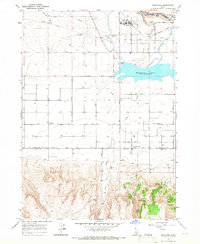
 1954 Pocatello1963 Print · USGSSoutheast Idaho in the mid-1950s reveals a landscape shaped by massive water reclamation and mountain forests. Researchers can trace the development of the Fort Hall Indian Reservation or locate specific landmarks like the Arbon P O and Emerson School.4 unique versions available
 - 1955 Map of Twin Falls, 1963 Print
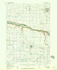
 1955 Twin Falls1963 Print · USGSThe Magic Valley flourished in the mid-1950s as a sophisticated network of irrigation and rail lines connected high-desert outposts. Researchers can trace the engineering of the Milner-Gooding Canal, the remote Murphy Hot Springs, and the Union Pacific rail network.3 unique versions available
 - 1958 Map of Twin Falls
 1958 Twin Falls1958 Print · USGSThe Magic Valley and Snake River Plain are captured here in the late fifties, showcasing a region defined by transformative irrigation projects and desert military ranges. Researchers can trace the Union Pacific rail lines and locate small outlying settlements like Wickahoney, Rogerson, and Hollister.2 unique versions available
 - 1958 Map of Pocatello
 1958 Pocatello1958 Print · USGSSoutheastern Idaho in the late fifties was a landscape of expanding reservoirs and historic trails. Genealogists and historians can trace the Old Oregon Trail, locate the Bannock Creek Indian Day School, and study the many Union Pacific rail sidings.2 unique versions available
 - 1964 Map of Burley SW, 1965 Print
 1964 Burley SW1965 Print · USGSSouthern Idaho in the mid-sixties shows an agricultural landscape defined by the Snake River and its massive irrigation projects. Genealogists and historians can trace the early river economy through sites like Starrhs Ferry and rail stops at Schodde or Hynes.2 unique versions available
 - 1964 Map of Kimberly, 1965 Print
 1964 Kimberly1965 Print · USGSSouthern Idaho's agricultural heartland and the deep Snake River canyon are captured here in the mid-sixties. Genealogists and local historians can trace the rail-side growth of Kimberly and Hansen or locate the historic Springtown (Site) near the Hansen Bridge.2 unique versions available
 - 1964 Map of Falls City, 1965 Print
 1964 Falls City1965 Print · USGSJerome County's agricultural and rail-dependent landscape is frozen in time during the mid-sixties, centered on the Union Pacific corridor. Researchers can trace the layout of small communities like Falls City and Barrymore or locate landmarks like the Radio Tower (KMVT).2 unique versions available
 - 1964 Map of Twin Falls, 1965 Print
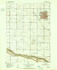
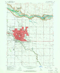 1964 Twin Falls1965 Print · USGSTwin Falls is shown at a point of significant post-war growth in the mid-sixties, with its urban center expanding toward the Snake River canyon. Researchers can trace local industry and education through the Sugar Factory, St Edwards Sch, and the Perrine Memorial Bridge.2 unique versions available
 - 1964 Map of Burley NW, 1965 Print
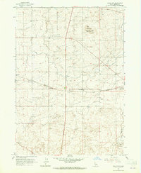
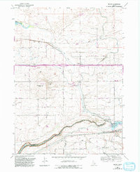
 1964 Burley NW1965 Print · USGSSouthern Idaho agricultural expansion is in full effect during the early sixties, shown here along the Jerome Co border. Genealogists and historians can trace the vital irrigation infrastructure of the era, from the Main Drain to the Aqueduct and numerous farm wells.
 - 1964 Map of Eden, 1965 Print
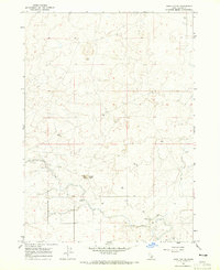
 1964 Eden1965 Print · USGSThe high desert of Jerome County comes alive in the early 1960s through its complex irrigation networks and rail-side settlements. Researchers can trace the agricultural heart of Eden and Hazelton, identifying local landmarks like Valley High Sch and the Grain Elevator.3 unique versions available
 - 1964 Map of Milner, 1965 Print
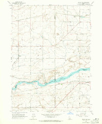
 1964 Milner1965 Print · USGSThe Snake River plains in the 1960s reveal an intricate web of desert irrigation and rail transport. Genealogists and historians can trace small settlements like Greenwood and Milner, alongside landmarks like Hazelton Butte and the Milner Dam.
 - 1964 Map of Hazelton NE, 1965 Print
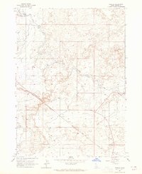
 1964 Hazelton NE1965 Print · USGSJerome County in the mid-1960s highlights the critical role of irrigation and volcanic geology in the Idaho desert. Researchers can trace the path of the Milner Gooding Canal and locate industrial landmarks like the Cinder Pits and Cinder Butte.2 unique versions available
 - 1964 Map of Perrine, 1965 Print
 1964 Perrine1965 Print · USGSJerome County in the early 1960s shows a landscape transformed by large-scale irrigation and the steel rails of the Union Pacific. Genealogists and researchers can trace the settlement at Perrine and find industrial markers like the No 4 Pumping Station and Diversion Dam.
 - 1964 Map of Hunt, 1965 Print
 1964 Hunt1965 Print · USGSJerome County's irrigation and settlement patterns are clearly visible in this mid-sixties survey of the High Desert. Historians can trace the development of Hunt and the massive infrastructure of the Milner Gooding Canal and Wilson Lake Reservoir.2 unique versions available
 - 1965 Map of Milner Butte, 1966 Print
 1965 Milner Butte1966 Print · USGSThe high desert of southern Idaho comes into focus in the mid-sixties as an engineered agricultural landscape. Researchers can trace the complex water systems of the Main Canal, locate the Lake Substation, and find early local landmarks like Milner Butte.2 unique versions available
 - 1965 Map of Murtaugh, 1966 Print
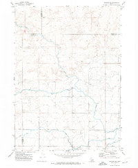
 1965 Murtaugh1966 Print · USGSThe Snake River Plain in the mid-sixties reveals an intensive network of canals and rail lines supporting the agricultural communities of Twin Falls and Cassia counties. Researchers can trace irrigation history and local genealogy through Murtaugh, the Bower Cem, and the rail-side infrastructure of the Union Pacific.2 unique versions available
 - 1965 Map of Milner, 1992 Print
 1965 Milner1992 Print · USGSJerome and Twin Falls counties are shown in the 1960s during a period of significant hydroelectric and agricultural development along the canyon. Researchers can trace the massive Milner Gooding Canal system, locate the Parsons (Site), and find family landmarks near Hazelton Butte.
 - 1971 Map of Shoshone SE, 1973 Print
 1971 Shoshone SE1973 Print · USGSIrrigation and excavation define this section of the Magic Valley in the early seventies. Genealogists and researchers can trace water rights and land use through the Milner Gooding Canal, various Lateral channels, and several Borrow Pits.2 unique versions available
 - 1971 Map of Star Lake, 1973 Print
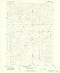
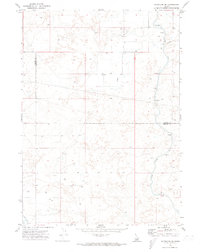
 1971 Star Lake1973 Print · USGSThe high desert of south-central Idaho in the early seventies shows a landscape transformed by water management and ranching. Trace the network of irrigation laterals and remote reservoirs like Rabbit Lake Reservoir or locate the significant Wilson Butte Cave.2 unique versions available
 - 1971 Map of Gooding SE, 1974 Print
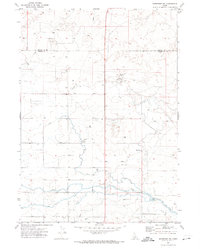
 1971 Gooding SE1974 Print · USGSThe intersection of Gooding, Jerome, and Lincoln Counties is shown in the early 1970s as a landscape of irrigation and desert tracks. Researchers can trace the water-management network through the Diversion Dam and Siphon, or follow remote Jeep Trails across the flats.2 unique versions available
 - 1971 Map of Shoshone SW, 1974 Print
 1971 Shoshone SW1974 Print · USGSSouthern Idaho's irrigated high desert is captured here in the early seventies along the border of Lincoln and Jerome counties. Genealogists and historians can trace water management infrastructure and land use through the North Side Main Canal and the Bacon Reservoir Ranch.2 unique versions available
 - 1971 Map of Owinza Butte, 1974 Print
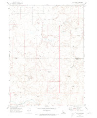
 1971 Owinza Butte1974 Print · USGSThe high desert of the Lincoln and Jerome county border is mapped here during the early seventies. Researchers can trace remote water sources and ranching landmarks like Owinza Butte Lake, Stage Barn Well, and the oddly named One Shot Lake.2 unique versions available
Showing maps 1-25 of 134
Top cities of Jerome County
Frequently asked questions
- What are the different types of historical maps available for Jerome County?
- What is the oldest map of Jerome County?
- Where can I purchase historical maps of Jerome County for my home or office?
- Where can I download high-res historical maps of Jerome County?
- Are there historical topographic maps available for Jerome County?
- Is there historical aerial imagery available for Jerome County?
- Where are historical maps of Jerome County sourced from?