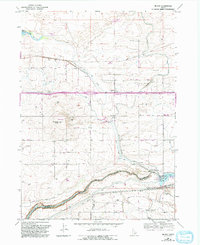
1965 Map of Milner
USGS Topo · Published 1992About this map
The Snake River defines the southern reach of this landscape, carving through a region heavily shaped by early 20th-century irrigation engineering. This 1960s-era survey, updated through the early 1990s, documents the intricate water management system centered around the Milner Dam and Milner Lake. The massive Milner Gooding Canal and North Side Main Canal stretch across the terrain, supporting the agricultural development that gave rise to small settlements like McHenry and Greenwood.
Find a feature on this map
26 named features on this map. Tap any name to fly to it.
Don’t see what you’re looking for? This feature index may not catch every label — zoom into the map to look around manually.
Map Details
Editions of this 1965 Milner Map
This is the sole edition of this map. No revisions or reprints were ever made.
Other maps of this area

1954 · Pocatello
USGS Topo · 1:250,000

1955 · Twin Falls
USGS Topo · 1:250,000

1958 · Twin Falls
USGS Topo · 1:250,000

1958 · Pocatello
USGS Topo · 1:250,000

1964 · Burley SW
USGS Topo · 1:24,000

1964 · Burley NW
USGS Topo · 1:24,000

1964 · Eden
USGS Topo · 1:24,000

1964 · Milner
USGS Topo · 1:24,000

1964 · Hazelton NE
USGS Topo · 1:24,000

1964 · Burley Butte
USGS Topo · 1:24,000