1964 Map of Milner
USGS Topo · Published 1965About this map
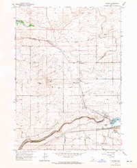
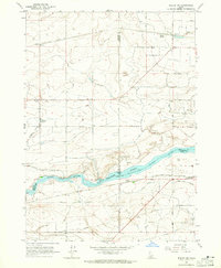
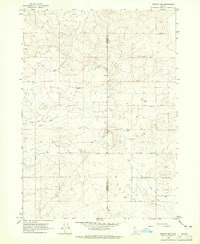
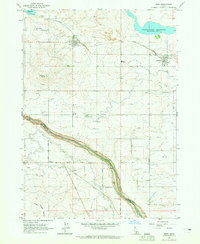
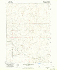
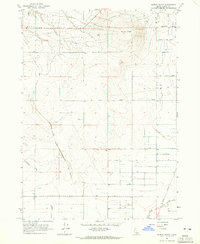
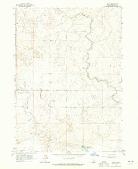
Snake River water management dominates the landscape of this southern Idaho region during the mid-1960s, centered on the critical infrastructure at Milner. The map captures the complex irrigation network born from the Milner Dam, including the North Side Main Canal, Main Canal, and Milner Gooding Canal. This system transforms the arid plains around Hazelton Butte, supporting small settlements like Greenwood and McHenry. The Union Pacific railroad parallels the river and canals, providing the vital transportation link for this agricultural economy. Local history is preserved in the location of the Cem near the riverbank and the small loading point at Parsons. The topographic detail reveals the engineering required to move water across this terrain, featuring various siphons, flumes, and the B-1 Ditch that feed into the larger reservoirs like Wilson Lake Reservoir.
Find a feature on this map
33 named features on this map. Tap any name to fly to it.
Don’t see what you’re looking for? This feature index may not catch every label — zoom into the map to look around manually.
Map Details
Editions of this 1964 Milner Map
This is the sole edition of this map. No revisions or reprints were ever made.
Other maps of this area

1954 · Pocatello
USGS Topo · 1:250,000

1955 · Twin Falls
USGS Topo · 1:250,000

1958 · Twin Falls
USGS Topo · 1:250,000

1958 · Pocatello
USGS Topo · 1:250,000
1964 · Burley SW
USGS Topo · 1:24,000
1964 · Burley NW
USGS Topo · 1:24,000
1964 · Eden
USGS Topo · 1:24,000
1964 · Hazelton NE
USGS Topo · 1:24,000
1964 · Burley Butte
USGS Topo · 1:24,000
1964 · Hunt
USGS Topo · 1:24,000